

Meteorologist Tony Nargi's First Warning Forecast
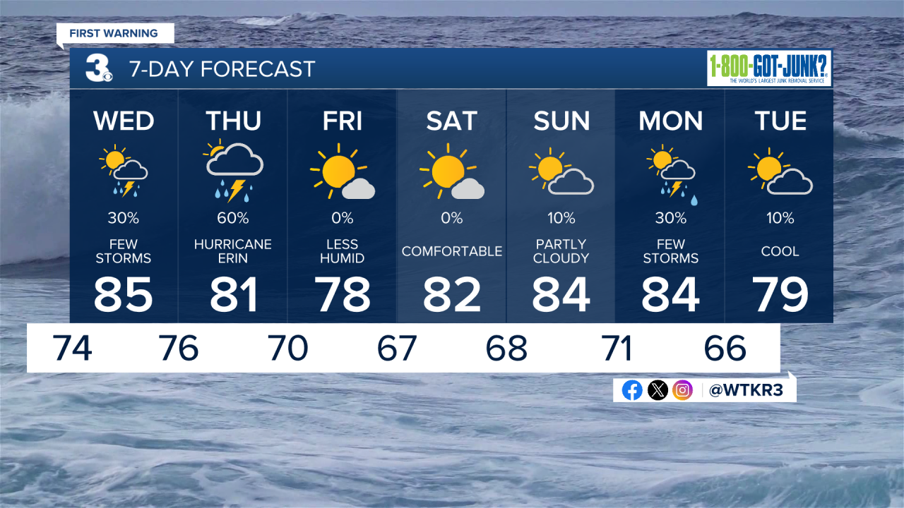
Tonight, temperatures fall into the low to mid 70s as a humid airmass remains in place and mugginess continues. Showers this afternoon should dissipate by the late evening.

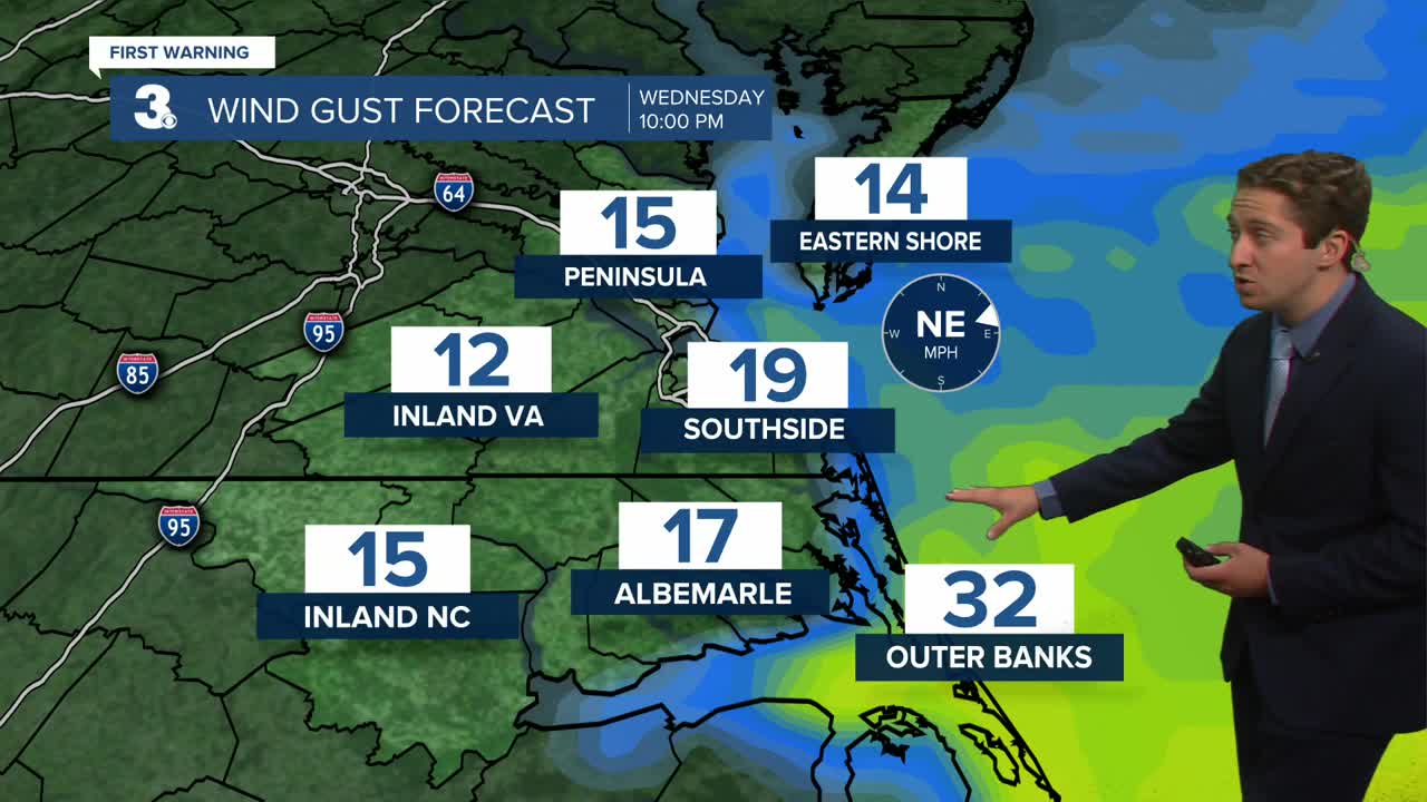
Tomorrow you can expect a warm and muggy start with mostly cloudy skies. We'll have a 30% chance for a passing shower or storm, with winds out of the ENE at 10-15 mph, picking up to 15-20 mph by the evening as Hurricane Erin approaches. Gusts over 30 mph are possible along the Outer Banks. Highs will reach the mid 80s with heat indices in the mid 90s.

Hurricane Erin will slide to our east on Thursday, bringing with it gusty winds, showers, and coastal flooding. Coastal flooding is expected to be the worst of those three impacts, with storm surge up to 4' expected along the Outer Banks, with 1-3' of storm surge from Currituck County up through the Oceanfront and Eastern Shores of Virginia. The first high tide on Thursday will be a bit before 7:00 AM, with the second high tide a bit after 7:00 PM. Both high tides could see coastal flooding, with the worst of the flooding likely occurring during the second high tide in the evening.


A Tropical Storm Warning is in place along the Outer Banks, where sustained winds could reach 45+ mph along with gusts over 60 mph at times. Winds along the Oceanfront and Eastern Shore will be steady between 25-35 mph, with gusts to 45 mph possible at times. Rainfall is not expected to be very significant, with between a 0.25" and 0.50" of rain expected from Hurricane Erin's outer bands. The main story will be about the storm surge and strong winds on Thursday, but isolated waterspouts and tornadoes will be possible as well. Temperatures will stay steady in the mid 70s to near 80 all day Thursday, with winds finally starting to calm down late in the day.

Behind Hurricane Erin, expect winds to calm down Friday throughout the day, falling from 15-25 mph in the morning down to 10-15 mph by the evening. We'll see plenty of sunshine as Hurricane Erin moves out to sea, with high temperatures in the low 80s and dew points in the low 60s.
TRACKING THE TROPICS
All eyes are on Hurricane Erin, who remains a category 2 hurricane at this hour and is continuing to move north. Erin is expected to remain a category 2 hurricane as it passes to our east on Thursday. Tropical Storm Warnings are in effect up and down the Outer Banks, with Tropical Storm Watches surrounding them.

Hurricane Erin will move out over the Northern Atlantic on Friday and continue to weaken into the weekend. Behind Hurricane Erin there are two more potential areas of tropical development. The first area out over the Central Atlantic has a medium (60%) chance of developing into a tropical depression, while the other area passing over the Cape Verde Islands has a low (30%) chance of development. Both areas are still well over a week away from being near the United States, but we'll continue to monitor them.

Weather updates on social media:
