


Meteorologist Maddie Kirker's First Warning Forecast:
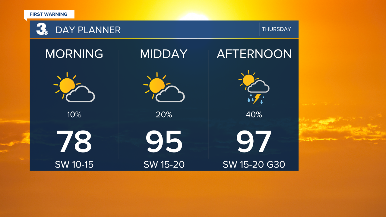
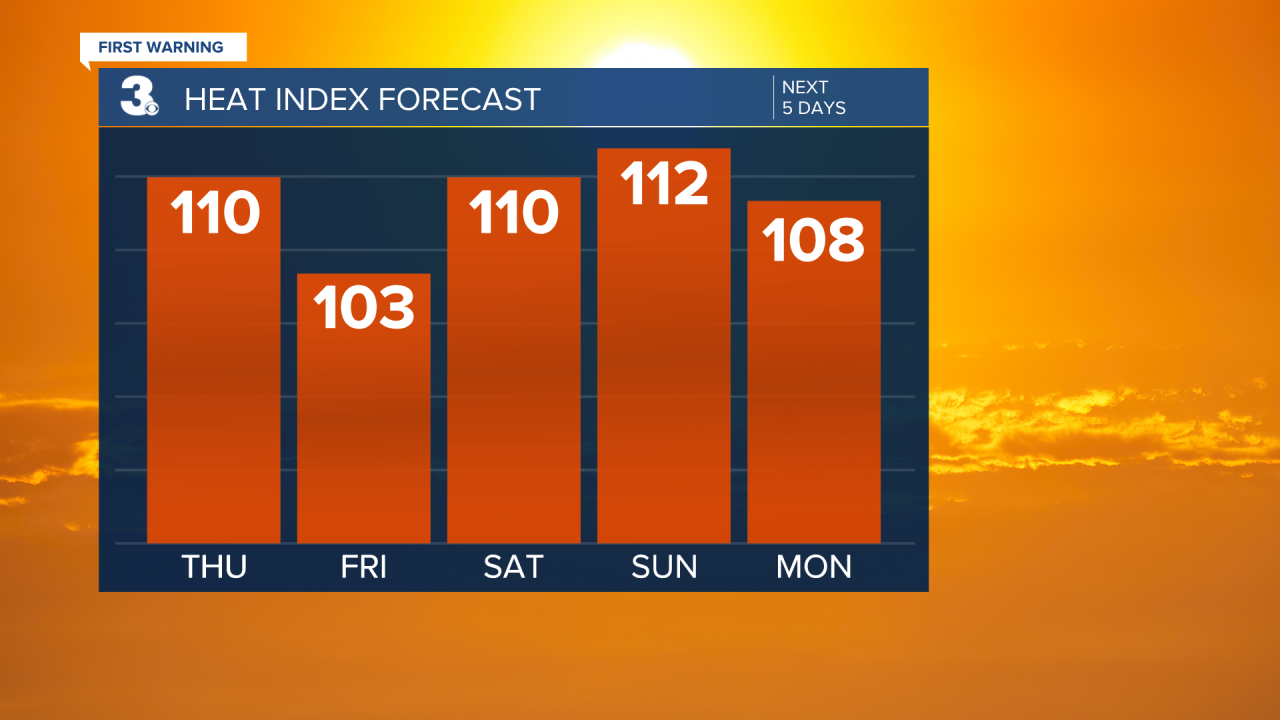
Highs will soar higher today to the upper 90s, with heat index values in the 100s.
The entire area is under a Heat Advisory with the exception of the Southside and Peninsulas who are under an Excessive Heat Warning due to higher dew points (higher heat index values near 110°) surrounding the Chesapeake Bay.


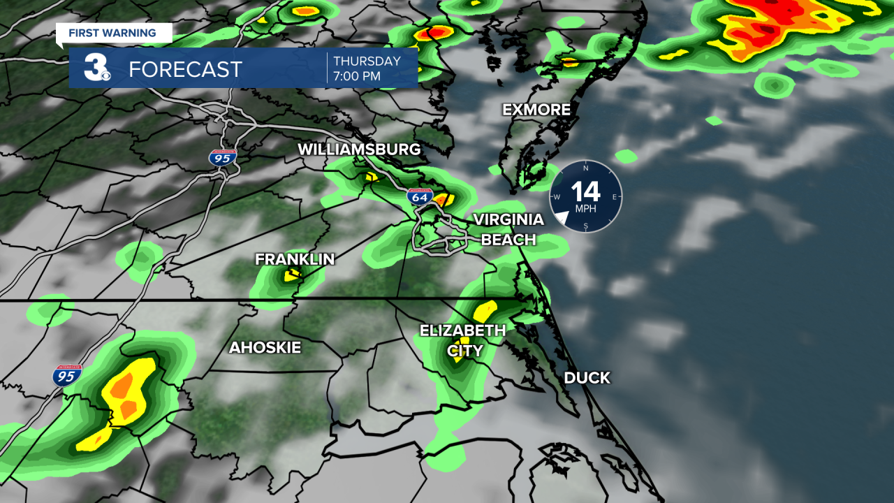
A weak cold front will move in this afternoon to evening increasing our chance of scattered showers and storms. The entire area is under a Level 1 Storm threat as some storms could be strong to severe with heavy downpours and gusty winds. Outside of our risk of severe storms, it'll be windy day with southwest winds 15 to 20 mph and gusts near 30 mph.


We'll "cool" to the mid 90s Friday behind the front but soar again to the upper 90s Saturday and Sunday. Parts of the area could actually touch the 100s with heat index values between 110 and 115 degrees. Unfortunately, Friday, Saturday and Sunday look mainly dry, with only the potential of a pop-up shower or storm.
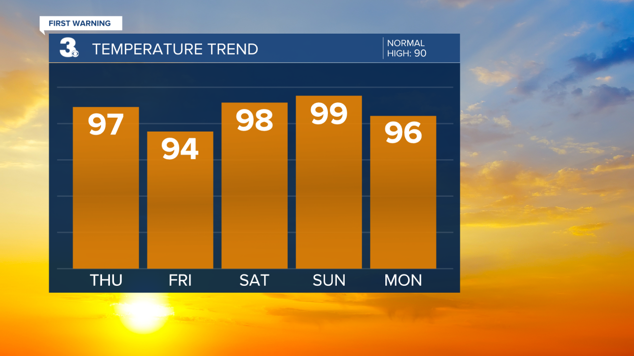
As we return back to work, storm chances will go up. Monday, Tuesday and Wednesday will feature the chance of showers and storms. Although Monday will still be hot, highs by Tuesday and Wednesday will drop to the low 90s, closer to normal for this time of year.
