

Meteorologist Tony Nargi's First Warning Forecast
This evening temperatures will taper off into the 50s and upper 40s, with clear skies and calm winds expected.

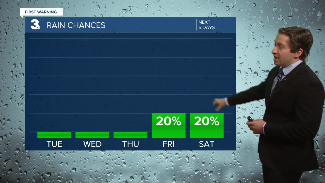
Tomorrow will start off chilly, with temperatures in the 40s and some 30s possible. Some patchy frost is possible inland. We'll see clear skies in the morning, with some patchy clouds possible during the afternoon. Highs will reach the mid 60s to low 70s. It will be a bit breezy by tomorrow afternoon, with winds out of the SW at 15-20 mph, gusting up to 30 mph. It will be a bit choppy on the water tomorrow, with waves of 2-4 feet on the Chesapeake and 3-5 feet on the Atlantic. A small craft advisory is in place.

On Thursday morning a cold front will slide through, with no precipitation expected but a drop off in high temperatures will follow the frontal passage. Temperatures will start off in the mid 40s to low 50s, with highs only reaching the low 60s. We'll see mostly sunny skies once again, with winds out of the NW at 10-20 mph, gusting up to 25 mph. Friday will be pleasant with high temperatures rebounding into the mid to upper 60s. We'll see mostly sunny skies to start, with some cloud cover building in during the afternoon. Winds will be out of the S at 10-15 mph.

This weekend will be warm, with high temperatures climbing into the 70s both days with a chance of rain increasing into Sunday. As we head into Monday and Tuesday, temperatures take a free fall into the 50s and 40s for highs!

Weather updates on social media:
