

Meteorologist Tony Nargi's First Warning Forecast
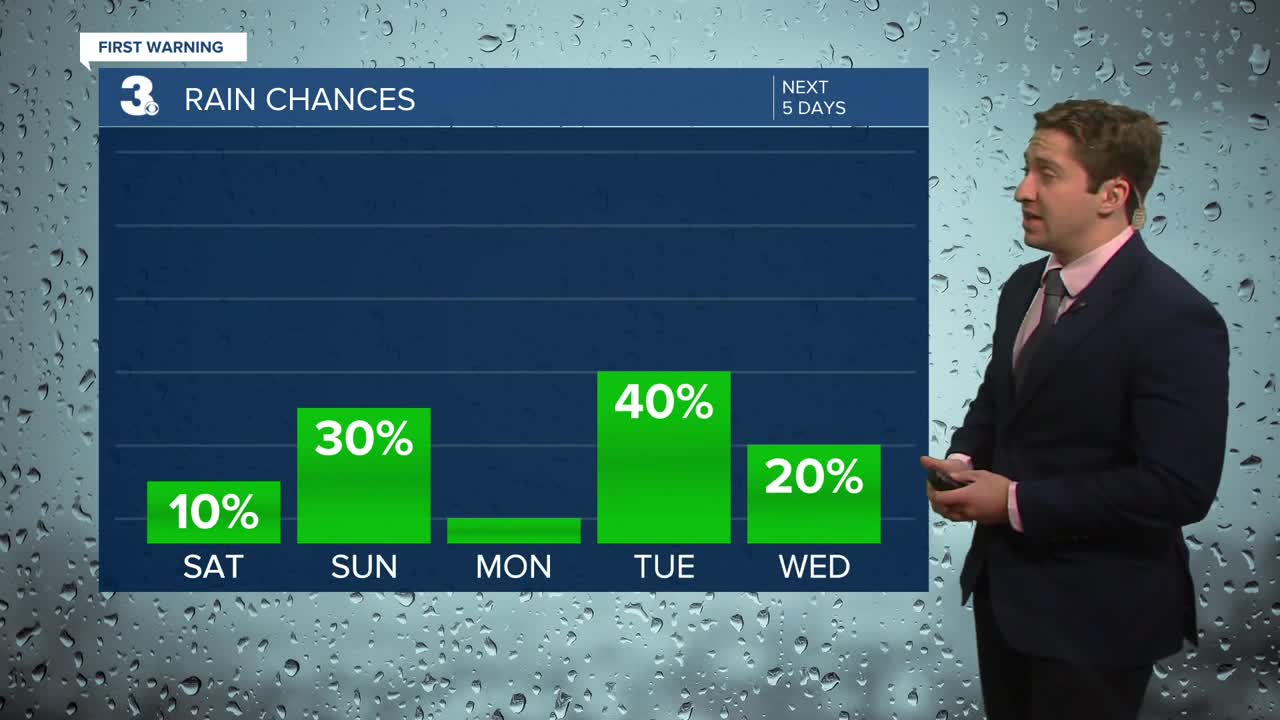
Today will start off with a mix of sun and clouds along with temperatures starting in the 50s. By the afternoon temperatures will jump into the low 70s with building clouds. It will be nice with light winds out of the WSW at 5-10 mph. Overnight we'll see mostly cloudy skies along with spotty showers possible as a cold front approaches. Temperatures tonight will drop into the 50s with winds picking up out of the SW at 10-20 mph.

A couple of showers will be possible tomorrow morning, with some clouds to start as well. Clouds will clear out by midday, with sunny skies expected by the afternoon. Highs will reach the upper 60s to low 70s, with winds out of the W at 10-20 mph. Temperatures will drop off quickly during the evening hours as colder air moves in. Temperatures on Monday morning will start in the upper 30s and low 40s. We'll see sunny skies on Monday with cooler high temperatures in the mid 50s.

After sunny skies on Monday clouds will fill in on Tuesday as our next chance of rain arrives late in the day on Tuesday. Temperatures will remain slightly below normal for most of next week, with a bit of a warmup possible on Friday.


Weather updates on social media:
