


Meteorologist Maddie Kirker's First Warning Forecast:
A cold front will move in front west to east today, bringing us gusty winds, heavy rain, and the potential for severe storms.

Our morning commute will be another warm and breezy one with a mix of sun and clouds. Some of us are starting out in the 70s this morning, already above our typical high temperatures for this time of year. Breezy southwest winds between 15 and 25+ mph will yet again soar our temperatures into the low 80s this afternoon, making it feel like summer. Most of the day will be dry but that will change quickly after 4pm.
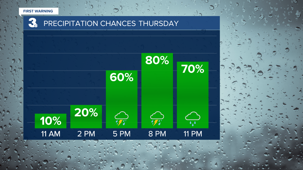
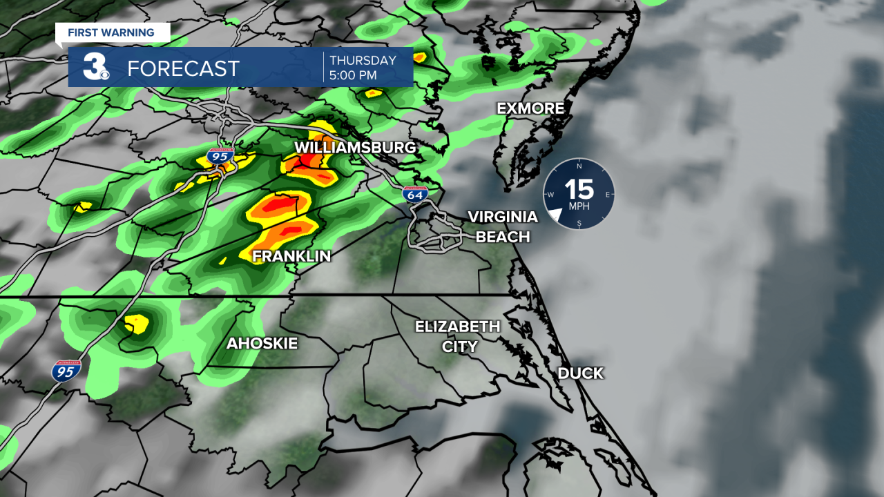
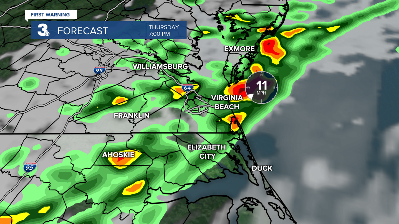
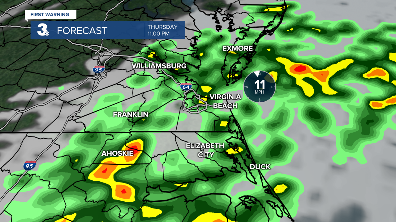
A potentially strong line of thunderstorms is set to move inland first, near I-95 and across the Peninsulas between 5 and 6pm, approaching the Southside and Albemarle of North Carolina between 6 and 7pm before exiting the coast, OBX and Eastern Shore between 9 and 10pm. Damaging straight line winds of 60 mph is our biggest threat but large hail will also be strong possibility. Once the strongest of the storms have pushed through, our saturated atmosphere will lead to widespread, lingering showers (and storms) through early Friday morning but by then, the severe threat will be over.
We'll get to kick off the holiday weekend nicely with clearing skies, sunshine, and cooler highs in the upper 60s Friday. Highs will return to the mid 70s Saturday but then drop back to the low 60s Easter Sunday. Expect a mostly cloudy skies and a chance for showers Saturday and a mix of sun and clouds Sunday.
