


First Warning Forecast:
Spring is just a few days away and spring-like temperatures and showers will be the story for the rest of the week. But will the rain taper off in time for Saint Patrick's Day?

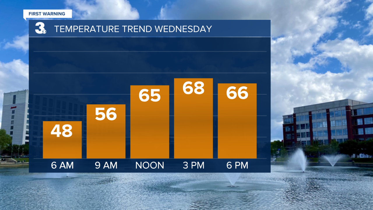
We'll start our Wednesday mostly sunny with increasing clouds during the afternoon. Despite the added clouds, highs will be warm and in the upper 60s.
Our next round of soggy weather is set to move in Wednesday night. Storms, some severe, will be possible through early Thursday morning and the entire area is under a level 1 threat (lowest threat) given out by the Storm Prediction Center. The biggest threat will be hail and a few strong wind gusts.


If you have St. Patrick's Day plans, just make them for a little later in the day. The widespread rain will become more spotty during the afternoon and it'll still be mild with highs in the low 60s.

Drying out and warming up just in time to end the work. Highs will soar to the low 70s. Showers will return on Saturday with highs near 70. Looking dry for those of you running the Shamrock on Sunday. It's also the First Day of Spring. We'll see highs in the low 60s under partly cloudy skies.

