
First Warning Forecast:
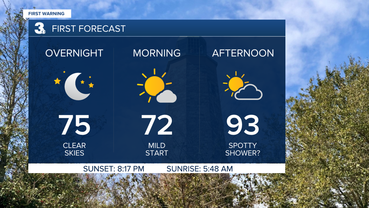
Get ready for another warm and muggy night with clear skies. We'll wake up Wednesday morning in the low 70s and soar again to the low 90s during the afternoon. Skies will be partly cloudy and as with any summer-like day, a stray shower/storm is possible.
More rain and storms will move in for the end of the work week with a cold front.
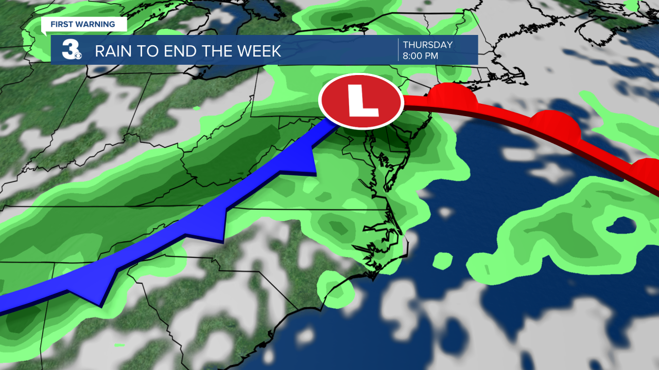
Scattered showers and storms are expected Thursday evening.
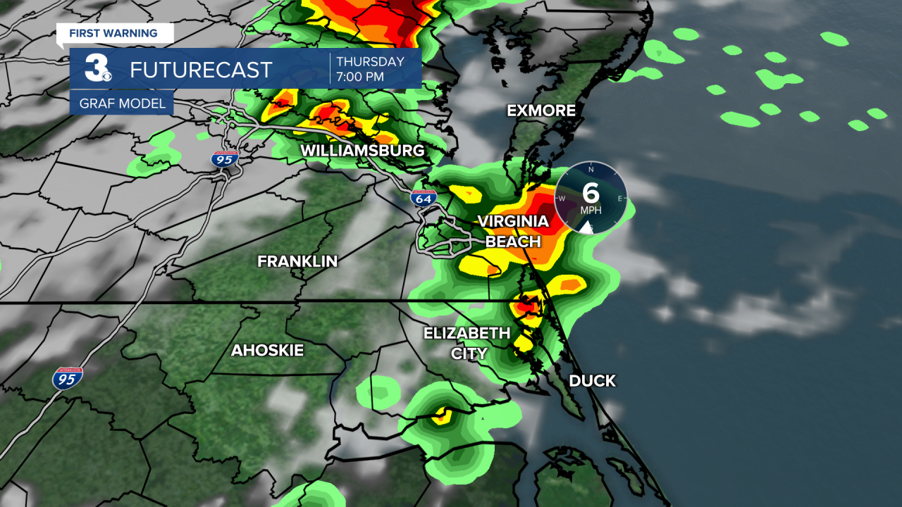
Strong to severe thunderstorms are possible with a higher risk to the north and lower risk to the south.

Scattered showers and storms will linger for Friday. Temperatures will also drop behind the front, from the low 90s on Thursday to the low 80s on Friday.
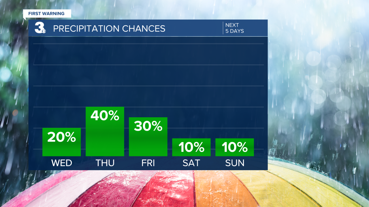
The upcoming weekend is looking nice but cooler. We should see partly cloudy skies with slim rain chances. Highs will dip to the upper 70s with lower humidity.

