

Meteorologist Tony Nargi's First Warning Forecast
Today will start off with a few clouds and temperatures in the 60s and low 70s. We'll quickly warm up into the 80s with mostly sunny skies emerging by the afternoon. It will be less humid, with dew points dropping into the low 60s. Winds will be out of the NW at 5-10 mph, turning S during the evening. Overnight will be clear, with lows in the 60s.

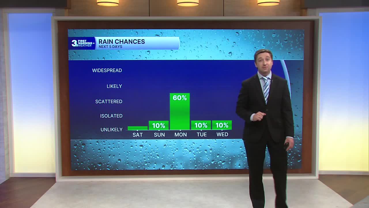
Father's Day (Sunday) will be excellent, with mostly sunny skies expected and high temperatures in the upper 80s to low 90s. We'll see winds out of the SW at 5-10 mph, with dew points staying low around 60. Overnight clouds will start to fill in with lows in the low 70s.

Monday will see the return of the heat and humidity, with high temperatures reaching the mid 90s and dew points climbing to near 70. The heat index will surpass 100 in many spots by the afternoon. We'll see partly cloudy skies followed by the chance for some afternoon/evening storms. There is a marginal (1/5) risk for severe storms on Monday, and an isolated strong to severe storm producing up to 60 mph gusts is possible. Overnight we'll see showers and storms linger, clearing out as we head towards Tuesday morning.

Tuesday and Wednesday will be mostly dry, with just low end (10%) chances of a stray afternoon shower or storm. High temperatures will stay near normal to end out of the work week. Another chance of rain arrives on Thursday.

Weather updates on social media:
