


Chief Meteorologist Patrick Rockey’s First Warning Forecast
New work week, new season.
After a big taste of summer this weekend with highs close to breaking heat records, clouds and rain along a cold front have moved back in for the first part of the work week.
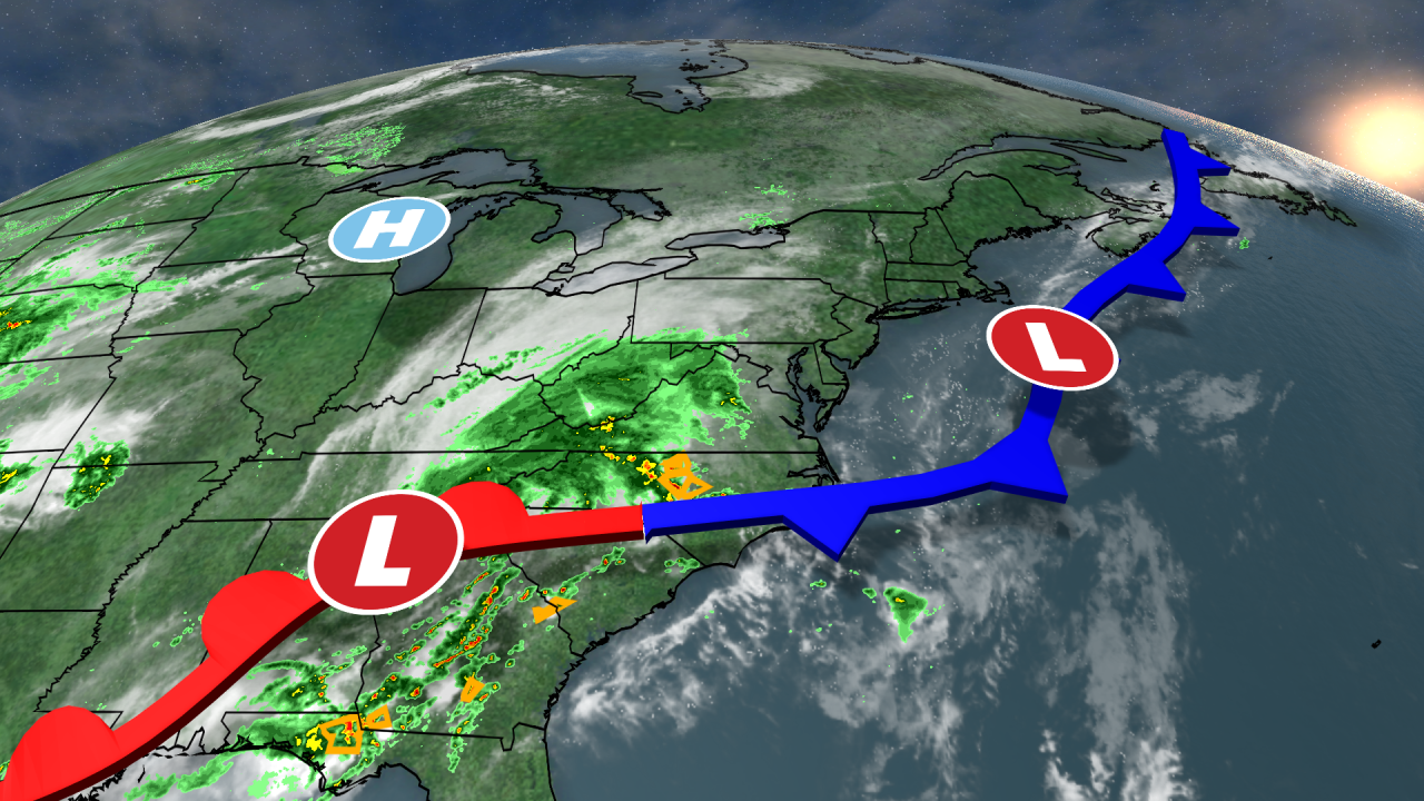
That means we can expect a big drop in temperatures and a little taste of fall. The cold front will linger just to our south for the next few days. Pieces of energy will spin along that front bringing us occasional showers and even a few thunderstorms from time to time.
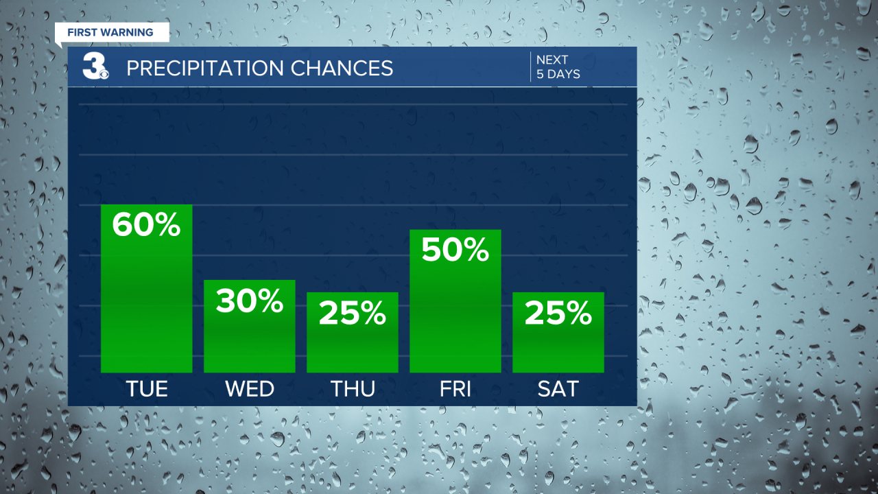
By Thursday that front will lift back north as a warm front and temperatures will climb into the 80s as we end the work week and head into the Memorial Day weekend.
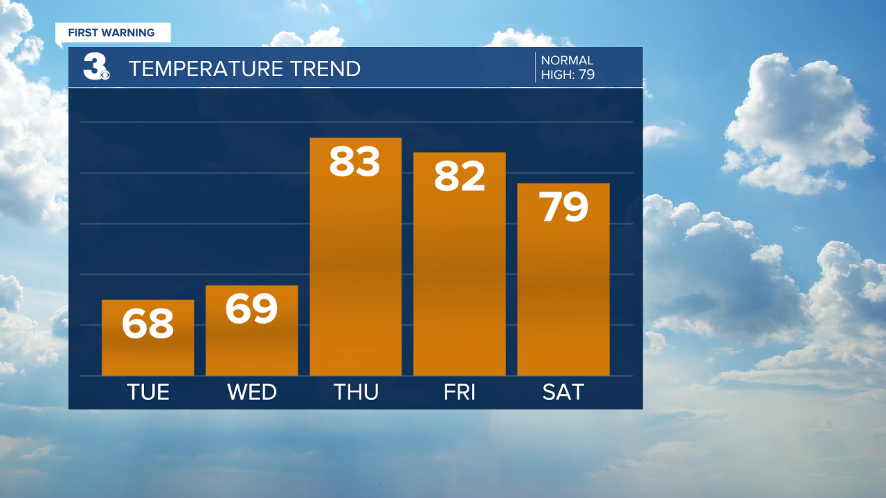
The holiday weekend is looking mainly dry and warm. Expect a 20-25% chance for a stray shower or thunderstorm, with temperatures warming into the upper 70s on Saturday, lower 80s on Sunday and mid 80s for Memorial Day itself on Monday.
Weather & Health
Pollen: Medium-High (Grasses, Oak, Birch)
UV Index: 8 (Very High)
Air Quality: Good (Code Green)
Mosquitoes: High
Today in Weather History (NWS Wakefield)
May 23rd
2005 F0 Tornado: Surry Co
2005 Severe Thunderstorms: East Central Virginia, Southeast Virginia - Hail 0.75"-1.00"
Chief Meteorologist Patrick Rockey
