First Warning Forecast:
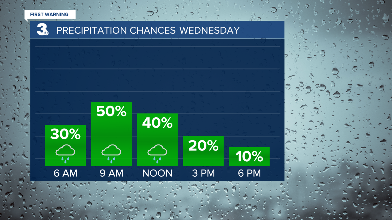
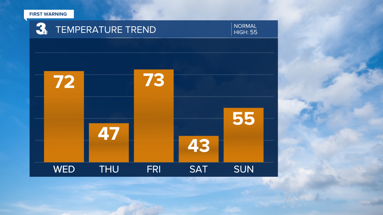
Several disturbances will move through the area to end the week. It'd be a good idea to keep the umbrella handy. The first will arrive Wednesday morning to midday and bring scattered showers. It'll be warm and muggy, with highs in the low 70s.
As our next wave of energy approaches from the west, colder air will filter in Wednesday night. This means Thursday will be 25 degrees colder than Wednesday. Highs will only be in the 40s.
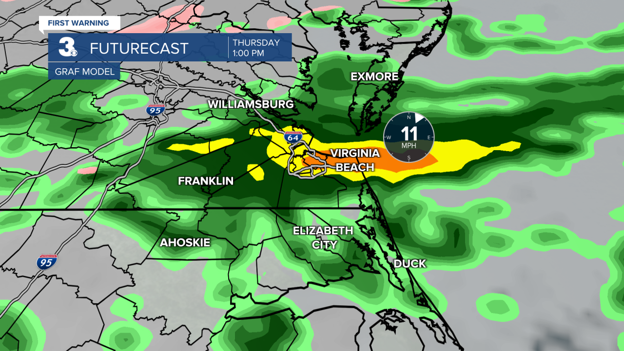
Our next round of rain will build in during the morning Thursday and become more widespread by Thursday afternoon to evening. Thursday features our highest chance of rain.
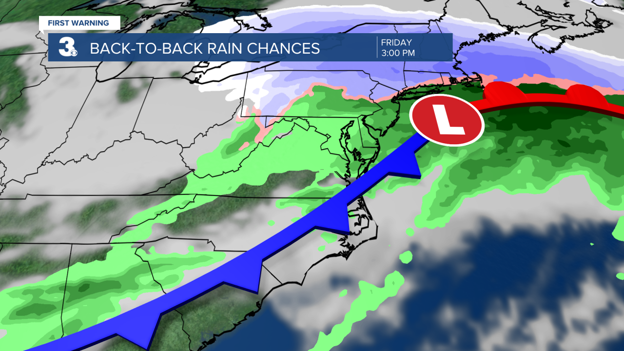
Another disturbance will move in on Friday that will bring us a slight chance of showers during the afternoon. Before the cold front arrives, highs will soar to the 70s.
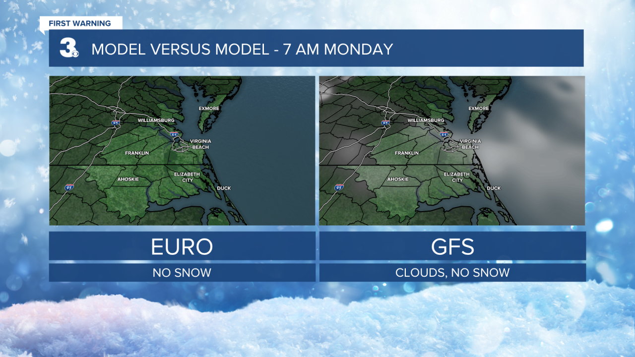
Temperatures will take another plunge on Saturday, but it will be dry with highs in the low and mid 40s. Scattered showers will return on Sunday. There is a slight chance we could see a few flakes mix in, but right now the event is looking like just rain. As pictured below, both of the long range weather models paint 0" accumulation Sunday through Monday morning. But we'll keep an eye on it.