

Derrah Getter's First Warning Forecast
Thursday will be our warmest day of the week. Temperatures make a run for 60 degrees. More clouds build in during the evening with a stray shower or two possible mainly along the Albemarle.
Temperatures drop to near 50 on Friday. A few spotty showers will be possible Friday afternoon.

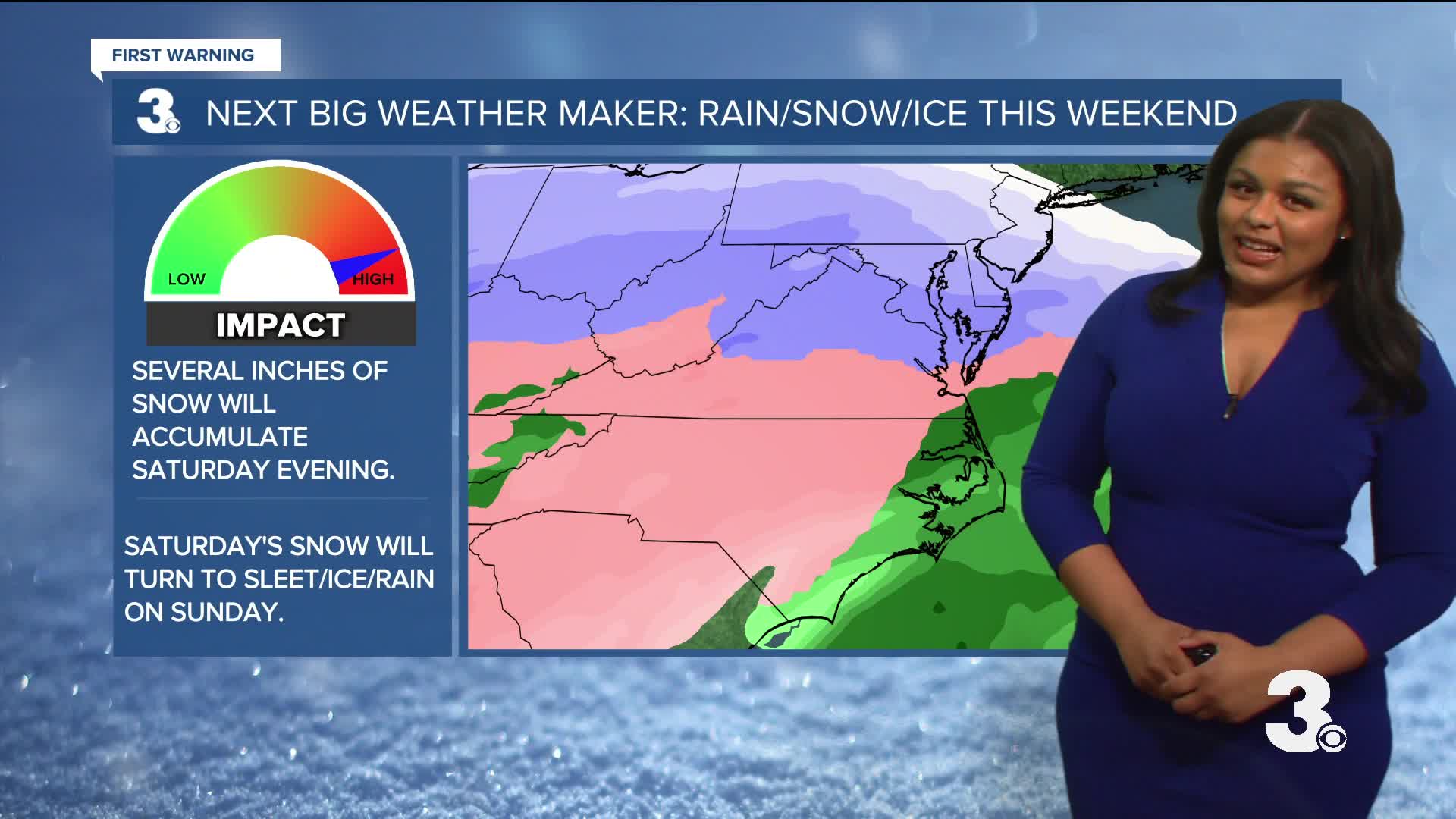
All eyes are on the weekend and a building winter storm. Saturday will be very cold, but the day will start out sunny. Clouds quickly fill in during the evening. The snow begins Saturday night. It will likely look like a “winter wonderland” come Sunday morning but once the rain begins Sunday afternoon, it will start to wash any snow we’ve accumulated and turn it into a slushy mess.

Wind chill values will be frigid Saturday morning. The National Weather Service has issued a Cold Weather Advisory for wind chill values between -5 and 5 degrees.

We’ll freeze the slush over Sunday night so be extra careful on the commute Monday morning. We stay cool with several days in the 30s and 40s.

Let's connect on social media!
Forecaster Derrah Getter:
For weather updates on Facebook: HERE
For weather updates on X: HERE
Follow me on Instagram: HERE
Check out the Interactive Radar on WTKR.com: Interactive Radar
Watch related coverage: Gov. Abigail Spanberger declares state of emergency ahead of winter weather's arrival
