Meteorologist Maddie Kirker's First Warning Forecast:
Extreme heat to kick off the weekend…
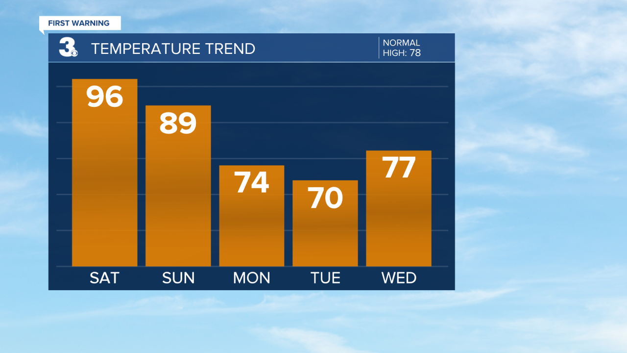
Highs will soar during to the upper 90s today, nearly 20 degrees above normal for this of year. This will put us near-record breaking heat.

Today's heat index values (feels like) will soar to between 100 and 105, although a few hours of 105+ will be possible away from the coast.

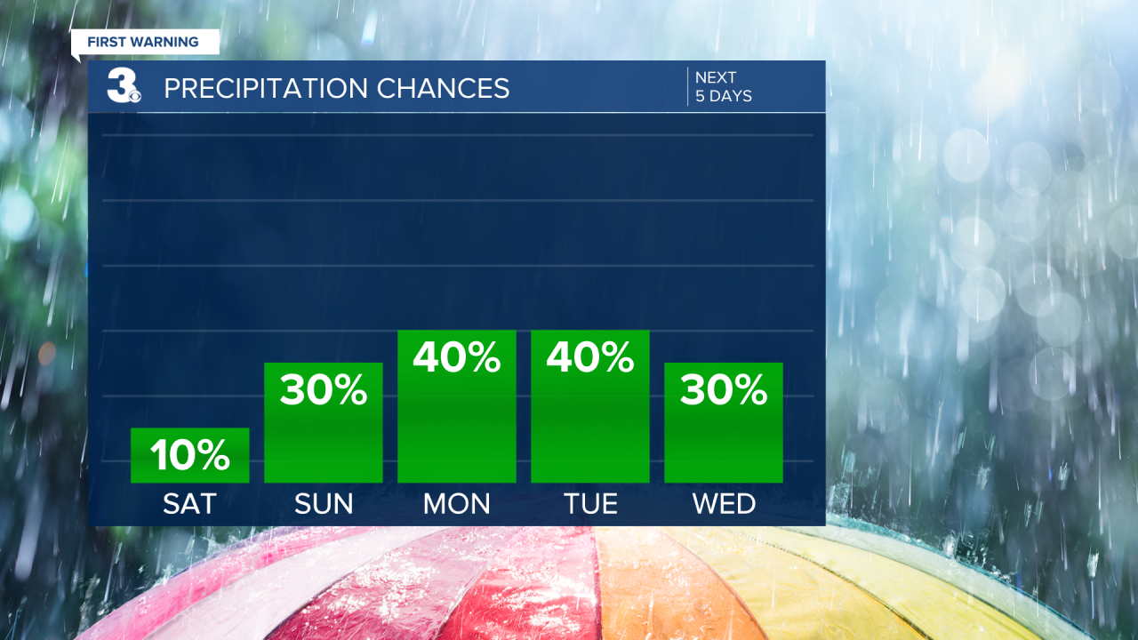
Scattered storms are possible this evening.
A slow-moving cold front will move in late Sunday and provide us with a big relief as we head into the upcoming work week. We'll stay toasty Sunday, just not as hot as Saturday with highs in the upper 80s to low 90s. Expect scattered showers and storms very late Sunday into Monday with the front likely slowing and stalling leading to continued rain chances Monday through Wednesday. Rain cooled air will move in behind the front and highs will drop to the mid 70s on Monday to the upper 60s by Tuesday