

Derrah Getter's First Warning Forecast
This afternoon was one of this week’s warmest. High temperatures reached the mid 70s, tying a record at Norfolk International set back in 1930.
The bright sunshine comes to an end this evening. Clouds build in overnight. A few spotty showers will be possible tonight with a lifting warm front.

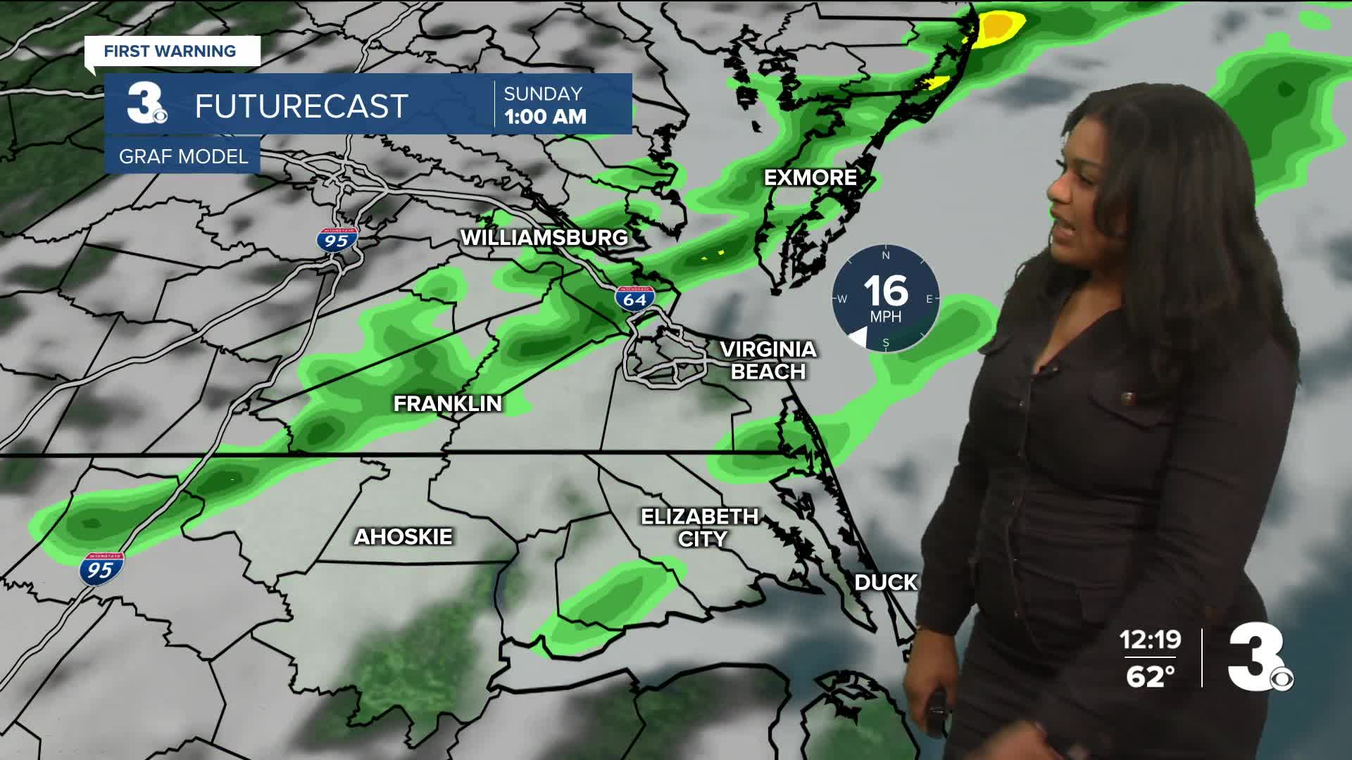
A strong cold front will bring rain this weekend. The main line of showers arrives Saturday with a few showers lingering into Sunday. Most of the moisture will stay confined to areas north and west closest to I-95 and Richmond, like the Peninsulas as well as the Eastern Shore.

Temperatures fall throughout the day on Sunday, and by Monday highs will be back in the 40s. Cooler conditions are anticipated throughout next week.

Let's connect on social media!
Forecaster Derrah Getter:
For weather updates on Facebook: HERE
For weather updates on X: HERE
Follow me on Instagram: HERE
Check out the Interactive Radar on WTKR.com: Interactive Radar
