


Meteorologist Myles Henderson’s First Warning Forecast
Tracking Hurricane Ian as it impacts Florida today and is set to move up the East Coast to end the week.
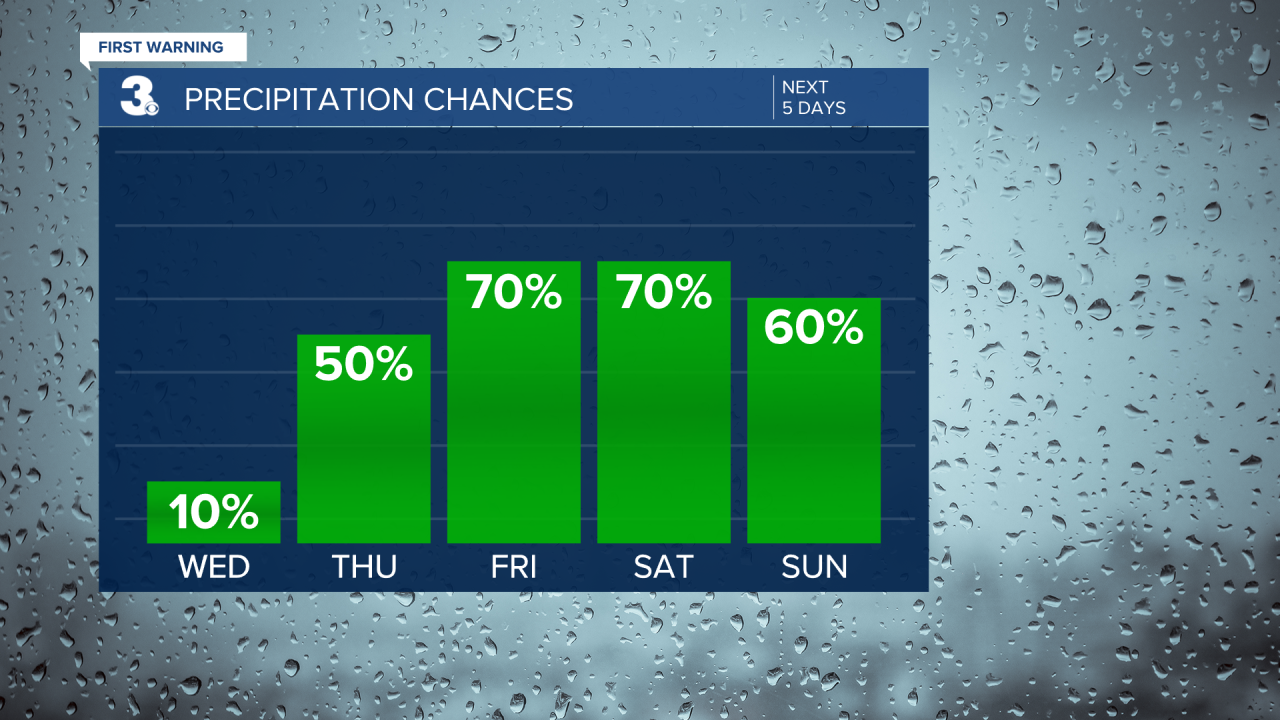
Another nice day with highs in the low 70s and low humidity for this time of year. We will see a mix of sun and clouds today with very low rain chances.
Clouds will continue to build in tomorrow (partly to mostly cloudy) and winds will kick up (NE 10 to 20, gusts to 30). Highs will return to the low 70s. Showers will start to build in later in the day. The biggest rain chance will be overnight.
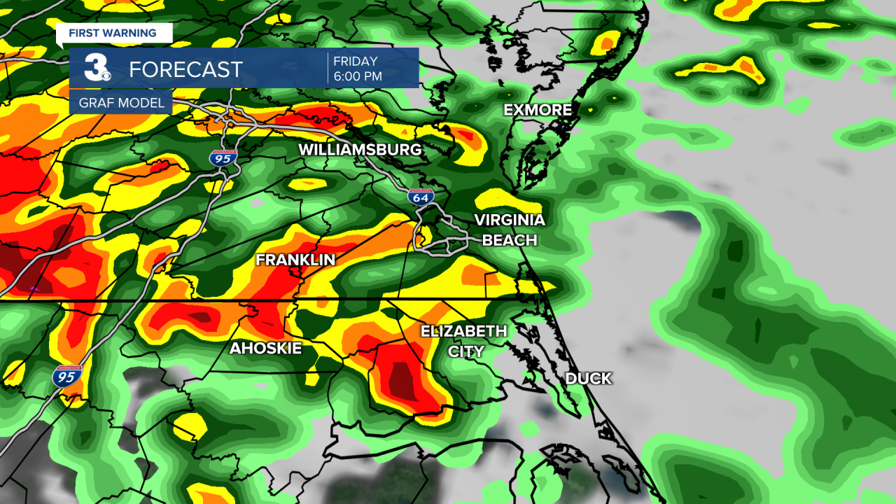
Friday will be our first messy day as the remnants of Hurricane Ian move up the East Coast. Expect cloudy skies with on and off showers and storms. Some storms could be strong to severe, biggest severe threat in NC. It will be windy Friday with NE winds at 15 to 25 and gusts to 35 mph.
The leftovers of Ian will linger over the Mid-Atlantic this weekend. Expect mostly cloudy skies with rain Saturday and Sunday. It will be windy both days with E/NE wind at 10 to 20 mph. Persistent E/NE winds will trigger some coastal/tidal flooding. We could see 4” to 6” of rainfall over the next several days.
Today: Partly Cloudy. Highs in the low 70s. Winds: N 5-10
Tonight: Partly Cloudy. Lows in the upper 50s. Winds: N 5-15
Tomorrow: Mostly Cloudy, Rain Late. Highs near 70. Winds: NE 10-20
Weather & Health
Pollen: Low-Medium (Ragweed, Grasses)
UV Index: 6 (High)
Air Quality: Good (Code Green)
Mosquitoes: Very High
Tropical Update
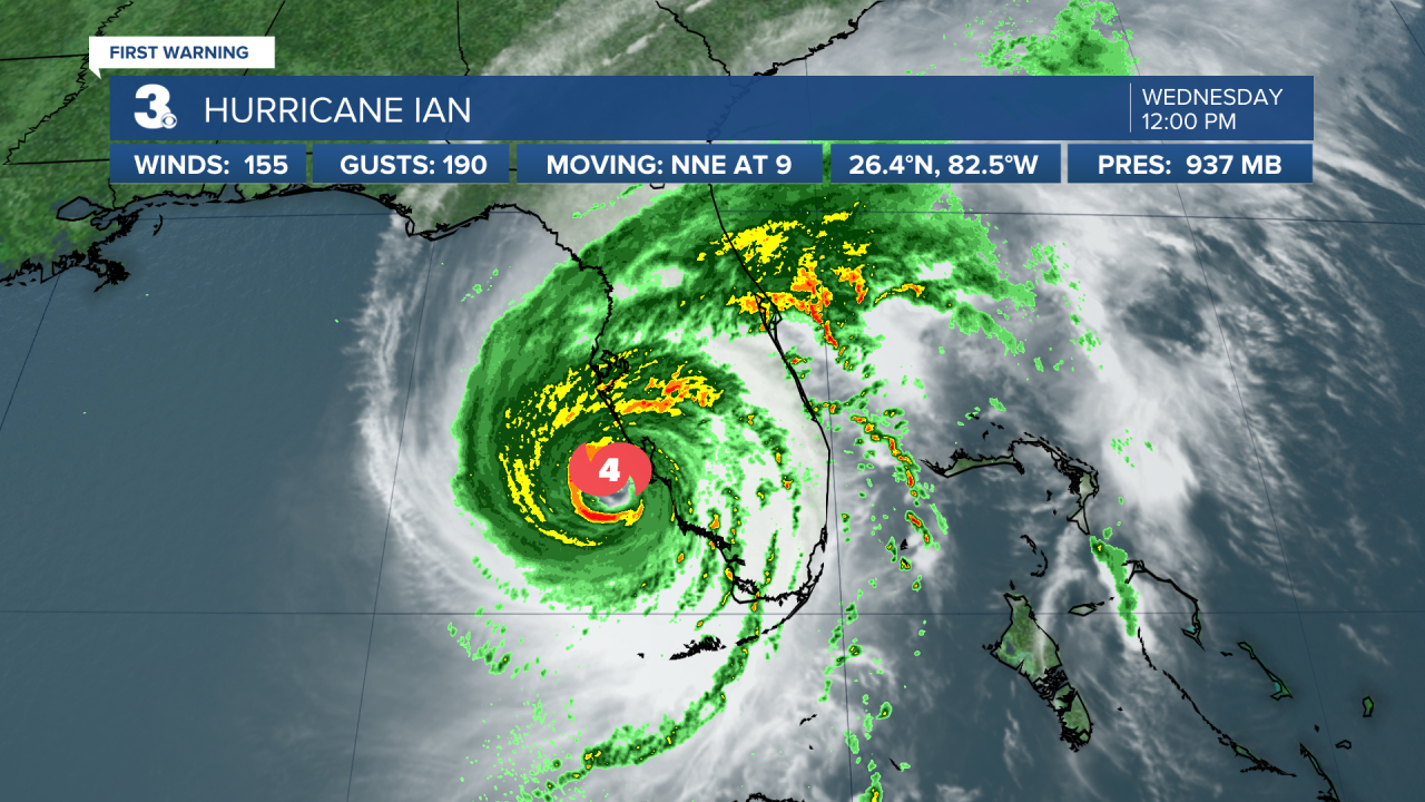
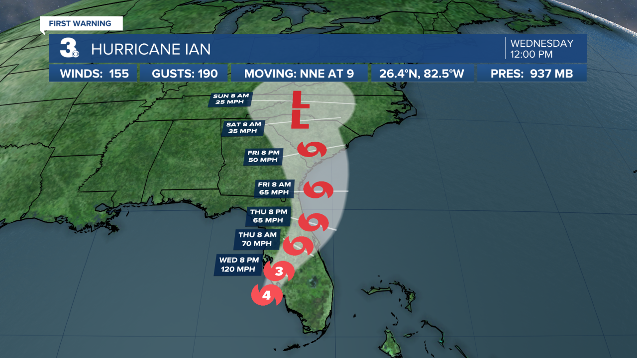
Eyewall of Ian moving onshore in Florida. Hurricane Ian is centered about 45 miles WNW of Naples, FL and moving NNE at 9 mph. On the forecast track, the center of Ian is expected to move onshore in a few hours, move over central Florida tonight and Thursday morning and emerge over the western Atlantic by late Thursday. Ian is forecast to turn north on Friday and approach the northeastern Florida, Georgia and South Carolina coasts late Friday.
Maximum sustained winds remain near 155 mph with higher gusts. Ian is a category 4 hurricane on the Saffir-Simpson Hurricane Wind Scale. Weakening is expected after landfall, but Ian could be near hurricane strength when it moves over the Florida when it approaches the northeastern Florida, Georgia and South Carolina coasts late Friday.
Hurricane-force winds extend outward up to 45 miles from the center and tropical-storm-force winds extend outward up to 175 miles.
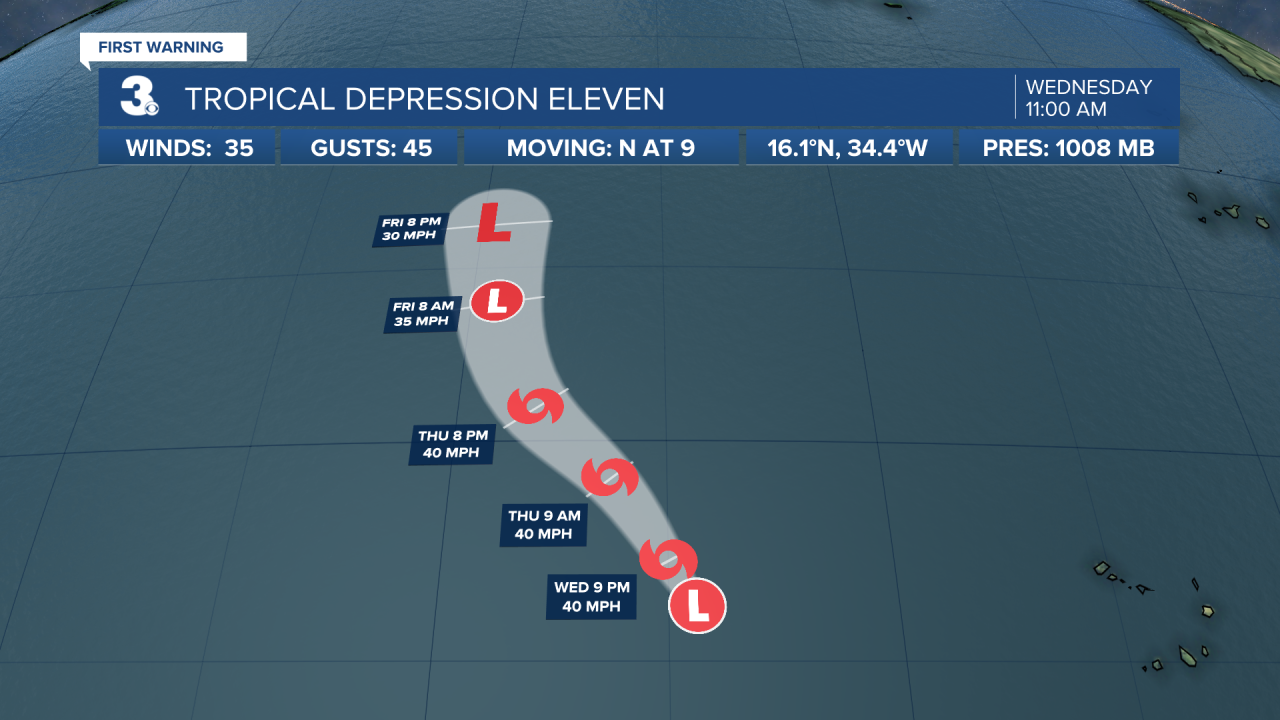
New tropical depression forms in the central tropical Atlantic. TD 11 is centered about 690 miles west of the Cabo Verde Islands and moving north at 9 mph. A general north to NNW motion is forecast over the next several days until the system dissipates. Maximum sustained winds are near 35 mph with higher gusts. Some slight strengthening is possible today, and the depression could become a short-lived tropical storm. However, weakening is expected by the end of this week, with the system dissipating by Saturday.
Weather updates on social media:
Facebook: MylesHendersonWTKR
Twitter: @MHendersonWTKR
Instagram: @MylesHendersonWTKR
