

Derrah Getter's First Warning Forecast
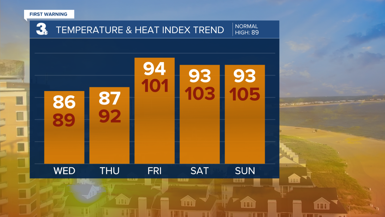
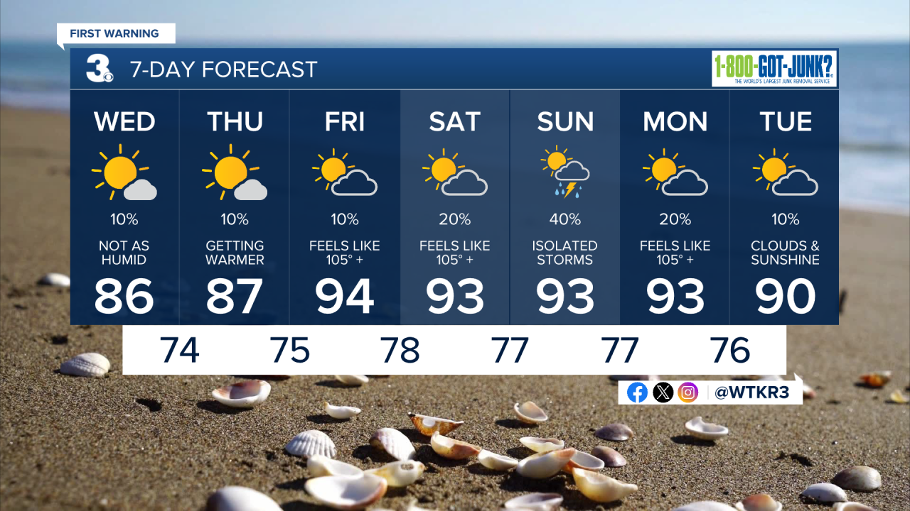
This morning will be mild and comfortable. Temperatures out the door will be in the mid 70s. The humidity will be noticeably lower.
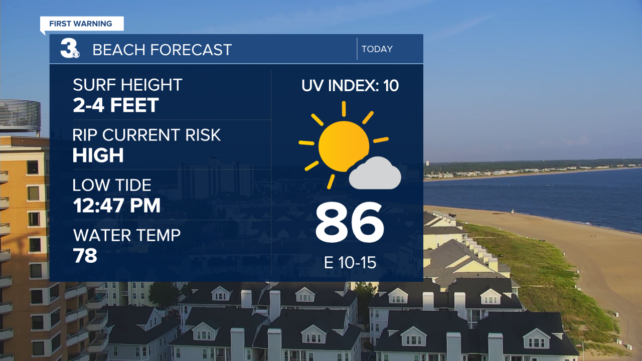
There is a high rip current risk in effect for all area beaches today. The highest time to see rip currents is typically at low tide. If you get caught in a current swim parallel to the shore not toward it.
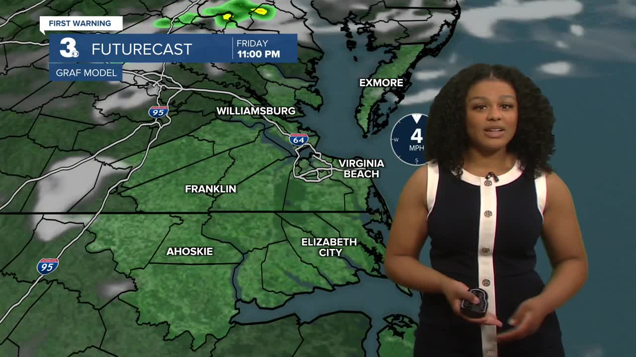
By the afternoon, highs reach the mid 80s. There will be plenty of sunshine. There’s only a small chance of a few isolated showers mainly south of Currituck.
The comfortable conditions fade after Wednesday. Heat and humidity build back in starting Thursday. Highs reach the mid 90s by the end of the week with “feels like” temperatures near 105.
We continue to stay mainly dry but a few isolated thunderstorms will be possible Sunday.
2025 Atlantic Hurricane Season Update
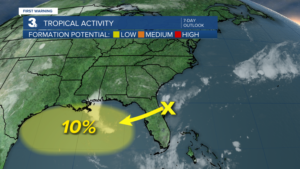
7/23, 2 am
An area of disorganized showers and thunderstorms near the northeast coast of Florida is expected to move over the peninsula and into the Gulf where some development will be possible. It is expected to weaken as it moves inland near Texas over the weekend.
Let's connect on social media!
Forecaster Derrah Getter:
For weather updates on Facebook: HERE
For weather updates on X: HERE
Follow me on Instagram: HERE
Check out the Interactive Radar on WTKR.com: Interactive Radar
