

Meteorologist Tony Nargi's First Warning Forecast
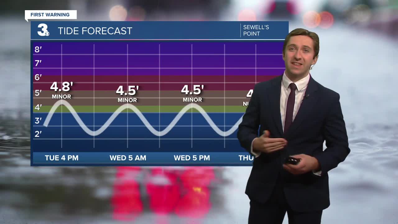
Cloudy skies will stay in place today with patchy drizzle possible. It will be cool and breezy, with highs in the 60s along with winds out of the N at 10-20 mph, gusting up to 30 mph. Tonight our skies will clear on out, with lows dropping into the upper 50s and low 60s. Another round of tidal flooding is possible this afternoon around 3/4 PM, with minor tidal flooding expected. A coastal flood advisory is in place until 7 pm. Rough seas are expected again, with 6-8 foot waves on the Atlantic and 4-6 foot waves expected on the Chesapeake, a small craft advisory is in place.


Tomorrow will be pleasant, with mainly sunny skies and highs in the low 70s. It will still be breezy, with winds out of the N at 10-15 mph, gusting to 25 mph. Some nuisance to minor tidal flooding is possible during the afternoon high tide, but a coastal flood advisory is not expected. Overnight a cold front will move through, knocking our temperatures down into Thursday and Friday.

We'll still see plenty of sunshine on Thursday and Friday, with breezy conditions both days and highs in the low to mid 60s. Dry weather continues into the first half of the weekend, with our next chance of rain possible Sunday afternoon/evening.

Weather updates on social media:
