

Meteorologist Maddie Kirker's First Warning Forecast:
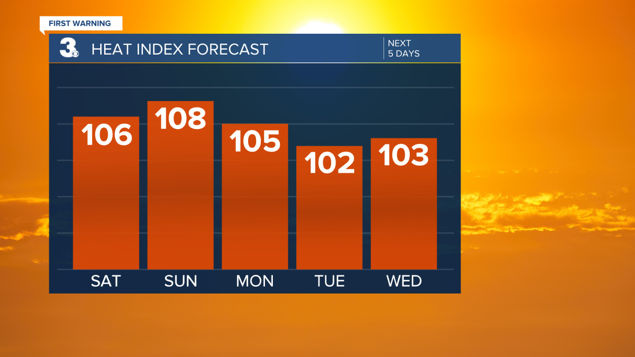
Get ready for more extreme heat this weekend. Highs will be in the upper 90s today with feels-like conditions between 100 and 105. Expect a hazy mix of sun and clouds with a only a stray shower or storm possible along the sea breeze this afternoon (20%). Winds will be light out of the southwest between 5 and 10 mph.
The hottest day of the weekend will be Sunday. Highs will soar to the upper 90s and parts of the area could actually touch the 100s with heat index values between 105 and 110 degrees. Sunday will also feature the slight chance of showers and storms.
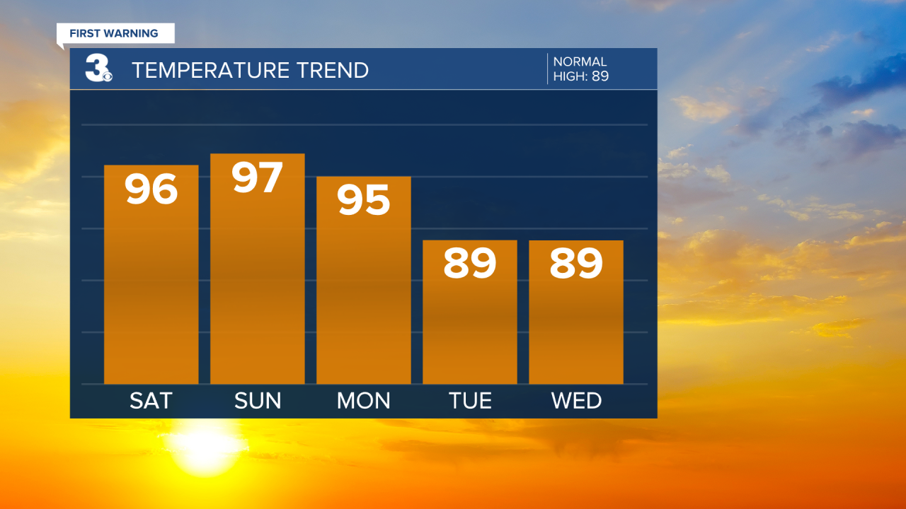
As we return back to work, storm chances will go up. Late in the day Monday a line of thunderstorms will move in across the northwestern part of the viewing area with scattered showers and storms expected Tuesday and Wednesday. Parts of the area are under a Level 2 storm threat Monday, mainly across the Eastern Shore and Peninsula. Monday will still be hot with highs in the 90s, but highs by Tuesday and Wednesday will drop to the upper 80s closer to normal for this time of year.

