

Meteorologist Tony Nargi's First Warning Forecast
This morning will start out sunny with temperatures in the 60s and low 70s. We'll see high temperatures reach the low 90s today for most, with slightly cooler conditions in the 80s along the immediate coastline. Winds will be out of the E at 5-10 mph, with mostly sunny skies expected. Overnight skies will be clear, with low temperatures dropping into the 60s and low 70s.

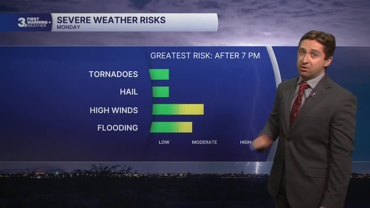
Tomorrow will be mostly sunny to start, with partly cloudy skies expected by the afternoon. High temperatures will reach the mid 90s, with heat indices in the low 100s as humidity climbs back into the region. It will be breezy, with winds out of the SW at 10-20 mph. We'll see isolated storms during the afternoon, with strong to severe storms likely during the evening. The best chance for severe storms will be on the Peninsulas and Eastern Shore, particularly between 7 PM and midnight.


Tuesday will feature some isolated showers during the morning followed by more widespread showers and passing (non-severe) storms during the afternoon. High temperatures will reach the mid to upper 80s, with dew points in the low 70s as well. Winds will be out of the W at 10-15 mph, turning out of the N during the afternoon. Overnight skies will clear, and we'll see mostly sunny skies return on Wednesday. Highs will reach the mid 80s on Wednesday with less humid conditions as well.

Another chance of rain looms later this week, with showers and storms moving in late in the day Thursday and lasting through Friday. High temperatures will stay around average, in the mid 80s to low 90s through next weekend.

TROPICS:
No activity at the moment, check back for updates!
Weather updates on social media:
