

Meteorologist Tony Nargi's First Warning Forecast
After a chilly start this morning with many areas starting off in the 30s temperatures will rebound into the low 60s this afternoon. Mostly sunny skies are expected along with light winds out of the N at 5-10 mph. Overnight temperatures will drop into the 40s. It should be a nice day for boating, with 1-3 feet waves expected. It will be dry, with dew points in the 40s expected.

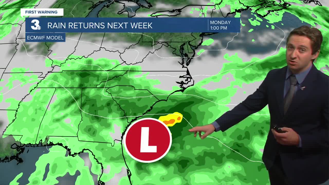
Tomorrow will start off mostly sunny with cloud cover increasing throughout the morning. Highs will reach the low 60s, with winds out of the NNE at 5-10 mph, increasing to 10-15 mph by the afternoon. Overnight skies will turn overcast as a low-pressure system starts to organize over the Carolinas. Mostly cloudy skies are expected by Monday with some spotty showers possible. Highs will stay near 60, with windy conditions expected out of the NE at 10-20 mph.


Showers are more likely to move in by Tuesday and Wednesday, with rain and wind expected along with high temperatures staying cool in the upper 50s and low 60s. Winds will be out of the NE at 15-25 mph, at times gusting up to 35 mph. Around 1-2 inches of rain is expected through Thursday, before calmer weather finally returns by Friday (In time for Halloween!).

TRACKING THE TROPICS

Tropical Storm Melissa is expected to undergo rapid intensification today. It will continue to move slowly west before turning northeast towards Jamaica and Cuba. The impacts in Jamaica and Cuba could be devastating, with extreme winds and immense rainfall expected for the Islands. If you have friends or family in those countries, urge them to evacuate or seek safe shelter. Melissa will eventually move out over the Atlantic, and interaction with the United States seems unlikely at this time.
Weather updates on social media:
