

Meteorologist Tony Nargi's First Warning Forecast
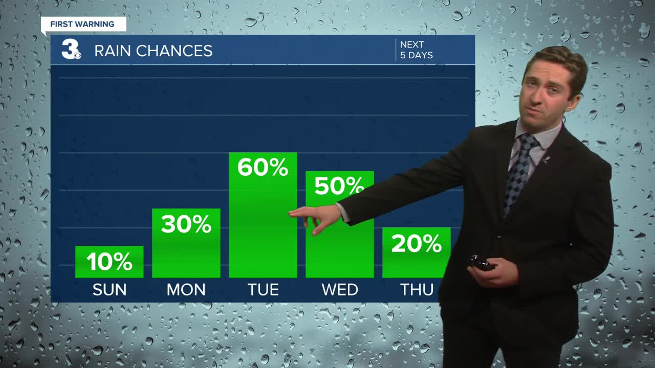
Today will be pleasant with highs in the mid 70s to low 80s. We'll see a mix of sun and clouds throughout the day, with more clouds than sun in Northeast North Carolina. Dry conditions are expected, with just a 10% chance of a passing shower. Winds will be out of the NE at 5-15 mph, with breezier conditions along the immediate shoreline. Surf conditions will be a bit rough, with 3 to 5 foot waves expected and along with a high risk of rip currents. Overnight we'll see a mix of sun and clouds with lows in the 60s.

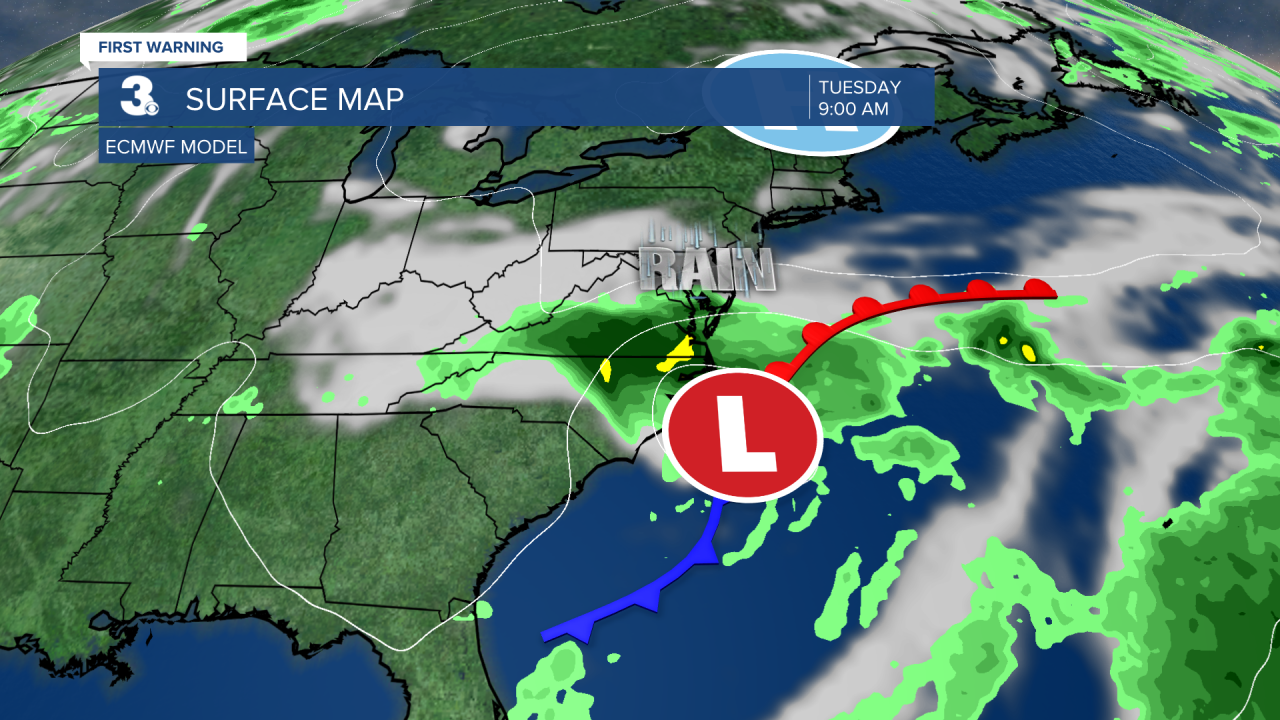
Tomorrow will start off with a mix of sun and clouds, becoming mainly overcast by the afternoon. Highs will reach the mid to upper 70s, with breezy conditions expected. Winds will be out of the NE at 10-20 mph. A few showers and thunderstorms are possible during the afternoon hours, with a 30% chance of rain. Overnight showers and storms will become more numerous as a coastal low will move onshore and strengthen. Steady rain along with some embedded thunderstorms are expected on Tuesday. It will be windy, with a steady NE wind at 15-25 mph, gusting over 30 mph at times. Tidal flooding will be a concern, with minor flooding forecast for Tuesday afternoon's high tide. Rain totals could reach over 2" for many areas, and isolated flash flooding will be possible where locally heavier amounts fall. Highs will be below normal in the low to mid 70s.

On Wednesday things will start to dry out, with some lingering showers possible throughout the day along with mostly cloudy skies and calmer winds. Highs will stay in the 70s through Thursday, with clearing expected by Thursday afternoon.

TRACKING THE TROPICS
An area of interest over the Main Development Region of the Atlantic now has a 60% chance of forming into a tropical depression over the next 7 days. This area needs to be monitored as it moves closer to North America, but right now it would still be 10+ day before being near our coastlines. We'll keep you updated as the week goes along.

Weather updates on social media:
