


Meteorologist Tony Nargi's First Warning Forecast
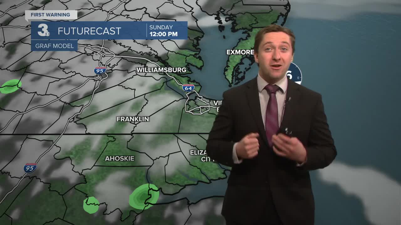
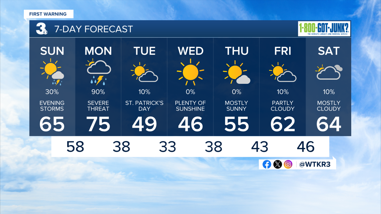
Monday will be windy and mostly cloudy with showers and non-severe storms in the morning. High temperatures will reach the 70s. Winds will be out of the S at 25-35 mph, gusting up to 45 mph at times! Severe weather will be possible from late morning onward, below is a breakdown of the timing and threats expected.
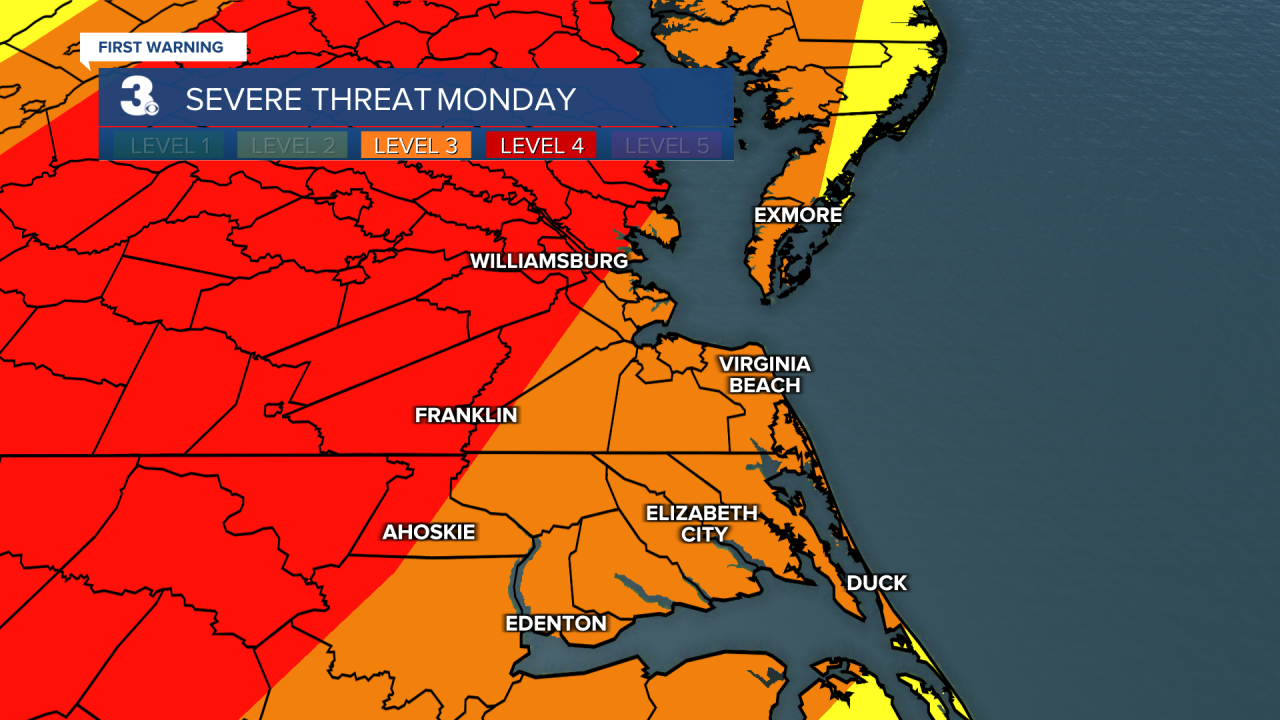
MONDAY SEVERE THREAT: A severe weather outbreak is likely on Monday for much of our area. We have a robust environment primed for all types of severe weather, and a rare Moderate (4/5) risk is in place. The first threat of thunderstorms will occur between late morning and mid afternoon. The second threat will occur later in the afternoon around sunset.
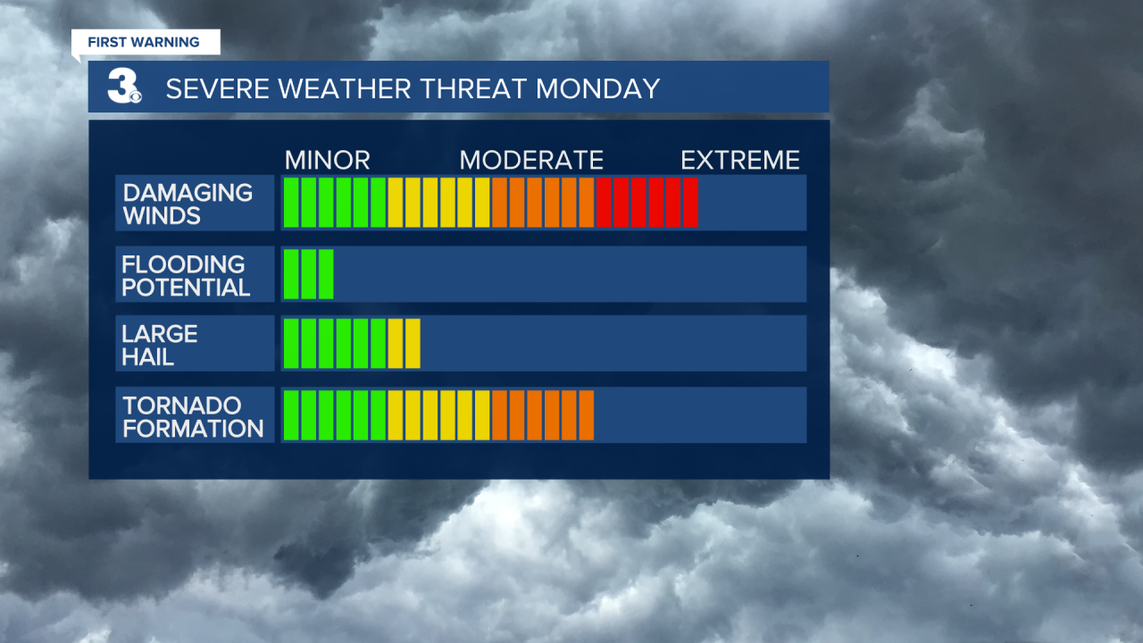
The first threat will be for supercell thunderstorms ahead of the approaching cold front. This is a lower confidence, but a high intensity forecast. If supercells do form in our area, the main threats will be for strong tornadoes, along with a secondary threat for large hail.
Watch: 3 things to do if a tornado is headed your way
Though our first threat will be less widespread and we have less confidence in supercells forming, if one does form it would be very damaging. An isolated strong (EF2+) tornado will be possible during the first threat period. Stay weather aware on Monday and have multiple ways to get severe warnings.

The second threat will be a higher confidence, with a lower intensity forecast. This will be the squall line that forms along the cold front. The threats here will be for strong wind gusts up to 70 mph and weak tornadoes. As the squall line moves through, expect frequent lightning, very gusty winds, and extremely difficult driving conditions. This will likely be late in the day, moving west to east and impacting most neighborhoods between 5 PM and 8 PM. Stay weather aware, and check the forecast or radar before your evening commute.
After our severe threat passes, we'll see calmer and cooler conditions. Temperatures will moderate towards the end of next week.
Weather updates on social media:
