

First Warning Forecast:
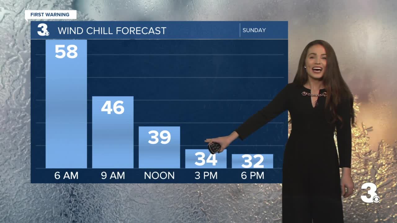
A strong cold front will move through the area today bringing in more rain and dramatically colder air. After starting in the 60s this morning, temperatures will plummet to the low 40s by midday. Expect widespread rain through midday with showers tapering off in the afternoon. Rainfall totals expected to be between .5" and 1.00". Winds will ramp up today, north at 10 to 20 with gusts to 30 mph. This will lead to wind chills this afternoon in the 30s.
The unseasonably cold air will continue Monday with highs in the 40s and mostly sunny skies. We are watching an area of low pressure expected to slide up the Carolina coast late Tuesday and Wednesday leading to more clouds and showers. Highs will linger in the low to mid 50s for much of the week and warm to the 60s again by Christmas Day.
