First Warning Forecast:
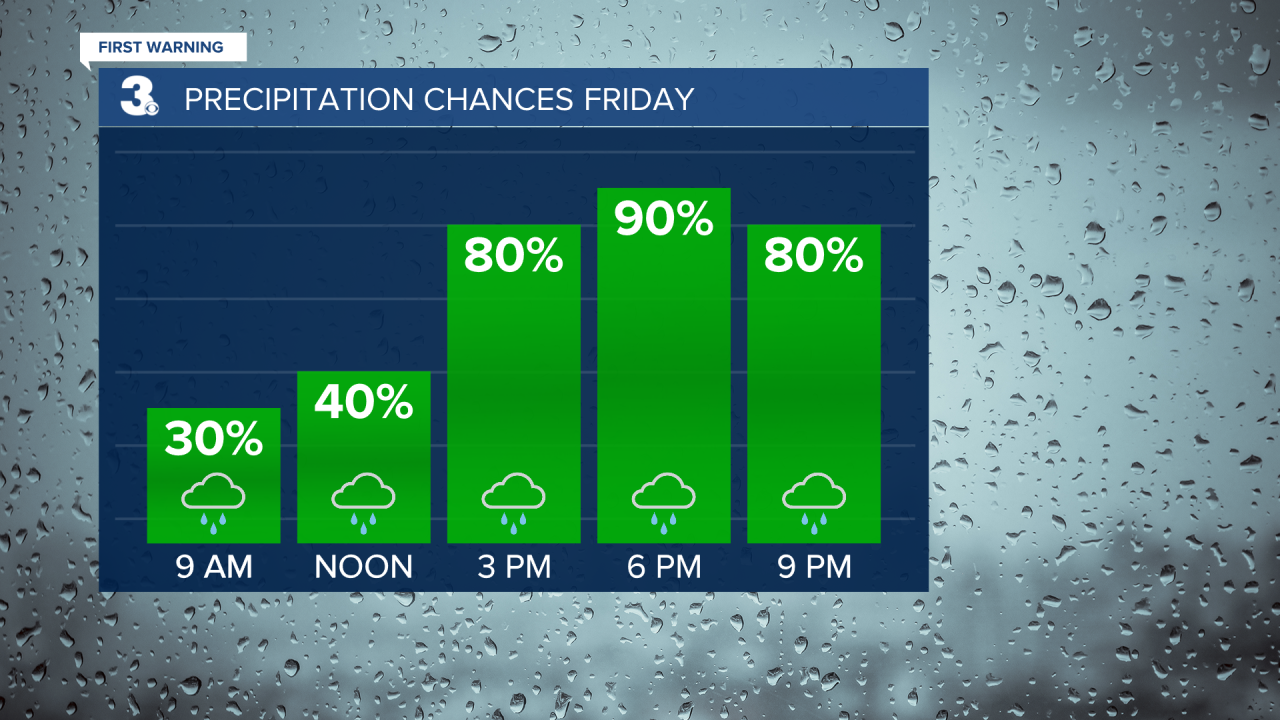
Rain will build in and become more widespread this afternoon to evening. It will be windy today with SW winds at 10 to 20 and gusts to 30 mph. Temperatures will drop quickly late this afternoon to evening as a cold front moves through.
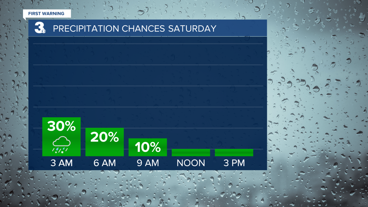
Rain will move out tonight to early Saturday morning. Some sleet or snow could mix in overnight, but no accumulation is expected. Clouds will clear out Saturday morning, but it will still be windy and much colder. Highs will only reach the upper 30s on Saturday. It will feel more like the upper 20s with north winds at 10 to 20 and gusts to 30 mph.
Sunday will be the nicer day of the weekend. We will see more sunshine with highs in the low 40s and light wind.
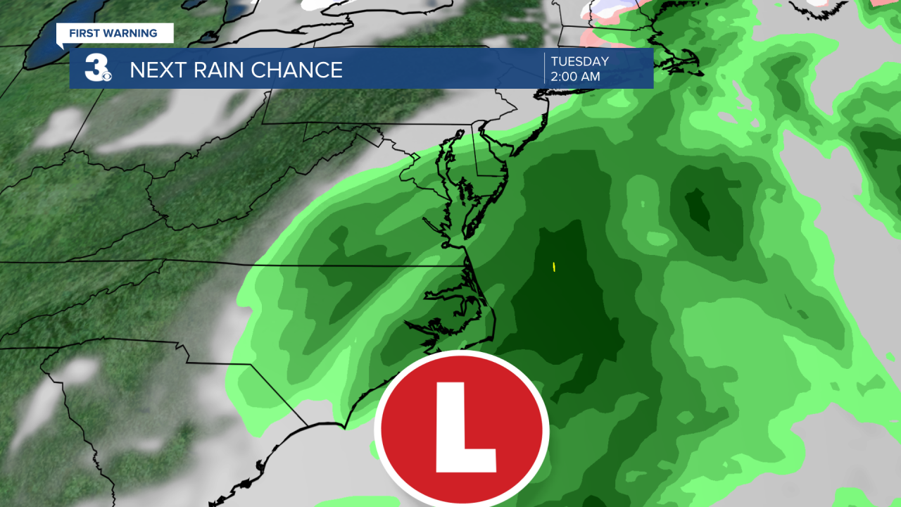
Our next round of rain is set to move in Monday PM to Tuesday AM as an area of low pressure slides up the East Coast. Highs will be in the 40s and 50 next week.