


Meteorologist Myles Henderson’s First Warning Forecast
Several days above freezing this week. Tracking a rain/snow chance for Wednesday. A cold and windy weekend.
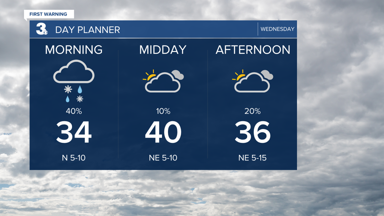
Expect mostly cloudy skies today with temperatures climbing to near 40 by midday then falling back into the 30s. Precipitation chances will be small during the day, but scattered rain/snow showers will build in this evening. The best chance for snow will be tonight to early Thursday morning. Snow accumulation is possible but minimal, between 0” and 1”.
Cold and windy on Thursday with mostly cloudy skies, highs in the mid 30s and a north wind at 10 to 20 mph.
Highs will sneak into the 40s on Friday. Expect partly cloudy skies with another minimal rain/snow chance Friday night.

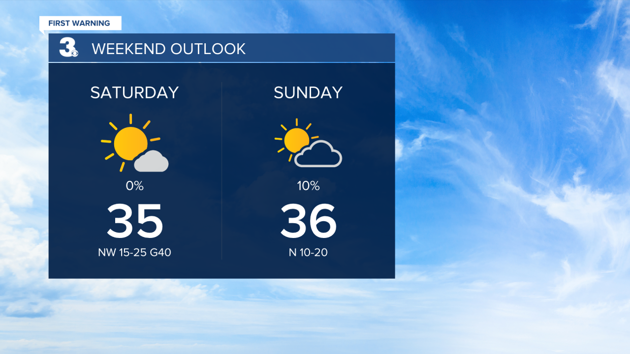
This weekend will be cold and windy. Highs will only reach the mid 30s both days, but it will feel more like the 20s with the strong wind. We will see mostly sunny skies on Saturday and partly cloudy skies on Sunday.
Today: Mostly Cloudy. Highs near 40. Winds: NE 5-15
Tonight: Rain/Snow Showers. Lows in the upper 20s. Winds: NE 5-15
Tomorrow: Mostly Cloudy. Highs in the mid 30s. Winds: NE 10-20
Weather updates on social media:
Facebook: MylesHendersonWTKR
Instagram: @MylesHendersonWTKR
