


Meteorologist Myles Henderson’s First Warning Forecast
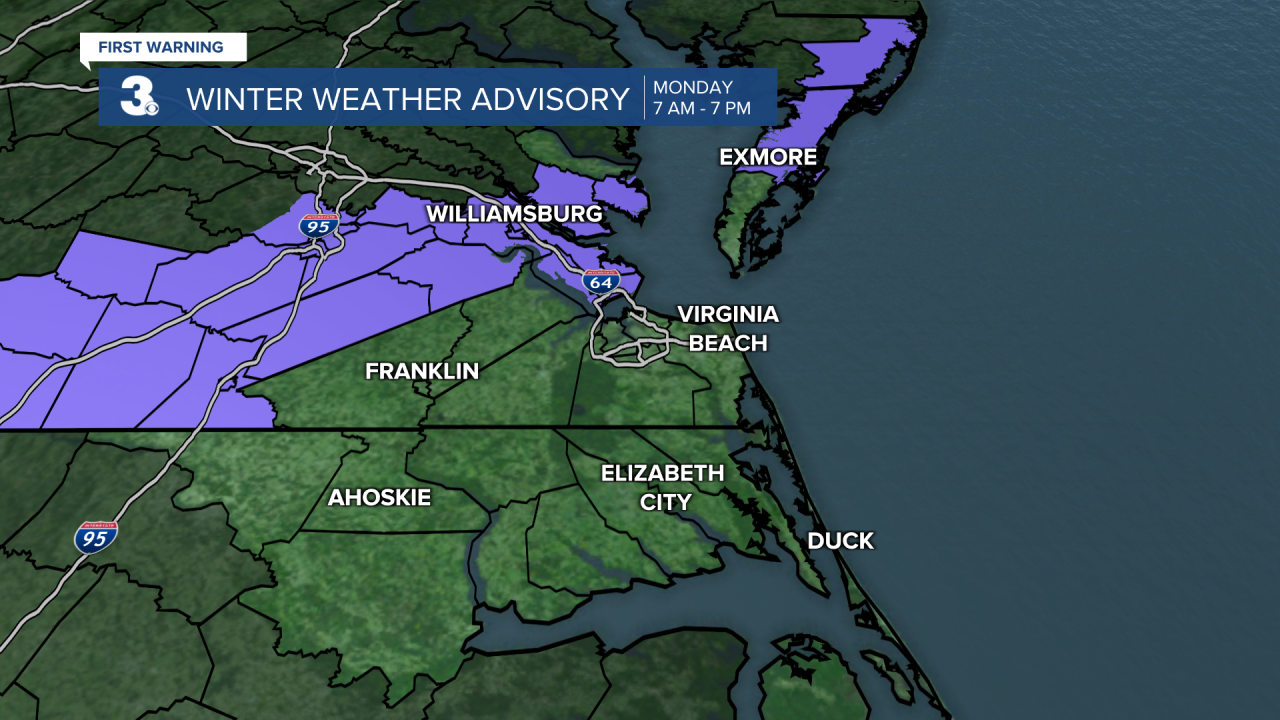

Rain, snow, wind, and flooding… Expect widespread rain this morning, heavy at times, with a threat for severe thunderstorms, mainly in NC. Rain will change over to snow from NW to SE through the midday hours. Rain/snow showers will wrap up this afternoon. A slushy snow accumulation is expected, especially on elevated and grassy surfaces. 2” to 4” expected for our areas to the north and west, 0” to 1” for areas to the south and east.
Wind will be another big issue today! NNE winds will ramp up 20 to 30 with gusts to 40+ mph. Prepare for potential power outages. Coastal flooding is expected near times of high tide today (mid-morning to midday). Overwash is expected on the Outer Banks.
Tuesday will by much nicer but cold. Expect temperatures in the 20s and 30s tomorrow morning. Wind chill values will drop to the low 20s and upper teens. We will see lots of sunshine tomorrow with highs only in the low 40s. It will feel more like the upper 30s tomorrow afternoon.
Highs will climb to the mid 50s on Wednesday with mostly cloudy skies and a chance for scattered rain showers. I am keeping my eye on another rain to snow chance Thursday night to Friday morning.
Today: Rain to Snow, Windy. Temperatures falling to the mid 30s. Winds: NE/N 20-30G40+
Tonight: Mainly Clear, Breezy. Lows in the upper 20s. Winds: N 10-15
Tomorrow: Mostly Sunny, Breezy. Highs in the low 40s. Winds: N/E 5-15
Weather updates on social media:
Facebook: MylesHendersonWTKR
Twitter: @MHendersonWTKR
Instagram: @MylesHendersonWTKR
