


Meteorologist Myles Henderson’s First Warning Forecast
Rain this morning, clearing out this afternoon. A cooler midweek, but back to the 70s this weekend.
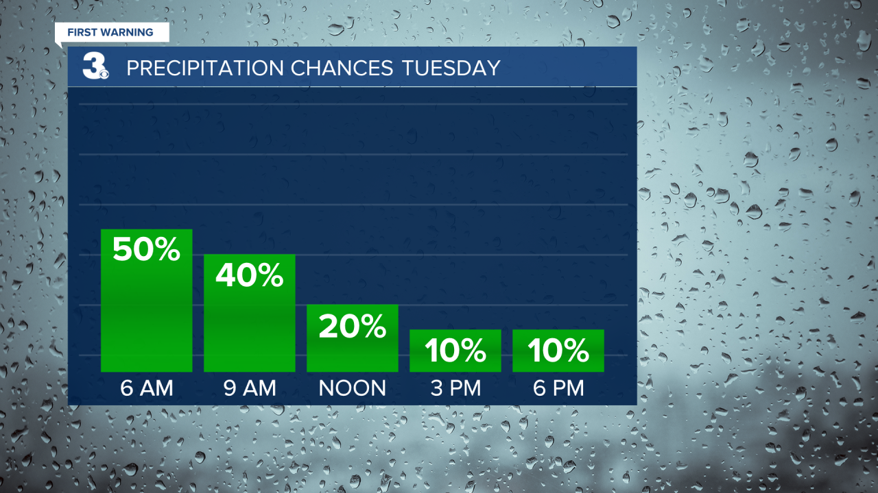
Expect mostly cloudy skies with scattered showers and isolated storms this morning. Showers will move out by midday and clouds will clear out this afternoon. Highs will return to the low and mid 70s today, above normal for this time of year.
Cooler air moves in for midweek. Expect highs in the mid 60s Wednesday with partly to mostly cloudy skies. We will see another clearing trend on Thursday with highs in the upper 60s.
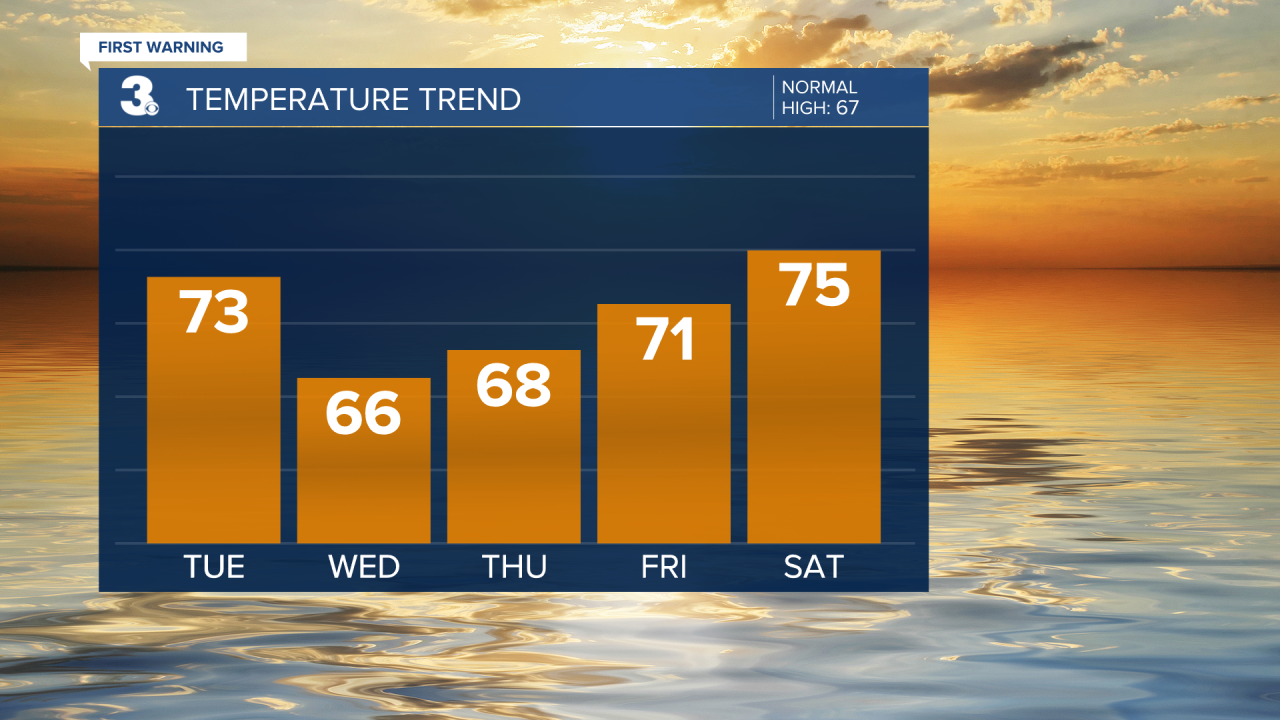
Temperatures will warm back to the 70s for the weekend. Expect mostly sunny skies Friday with highs in the low 70s. Highs will reach the mid 70s this weekend with more sun on Saturday and more clouds on Sunday.
Today: AM Rain, PM Clearing. Highs in the mid 70s. Winds: SW/NW 5-10
Tonight: Partly Cloudy. Lows in the mid 50s. Winds: N 5-10
Tomorrow: Partly to Mostly Cloudy. Highs in the mid 60s. Winds: N 5-15
Weather & Health
Pollen: Low (Ragweed)
UV Index: 3 (Moderate)
Air Quality: Good (Code Green)
Mosquitoes: Moderate
Tropical Update
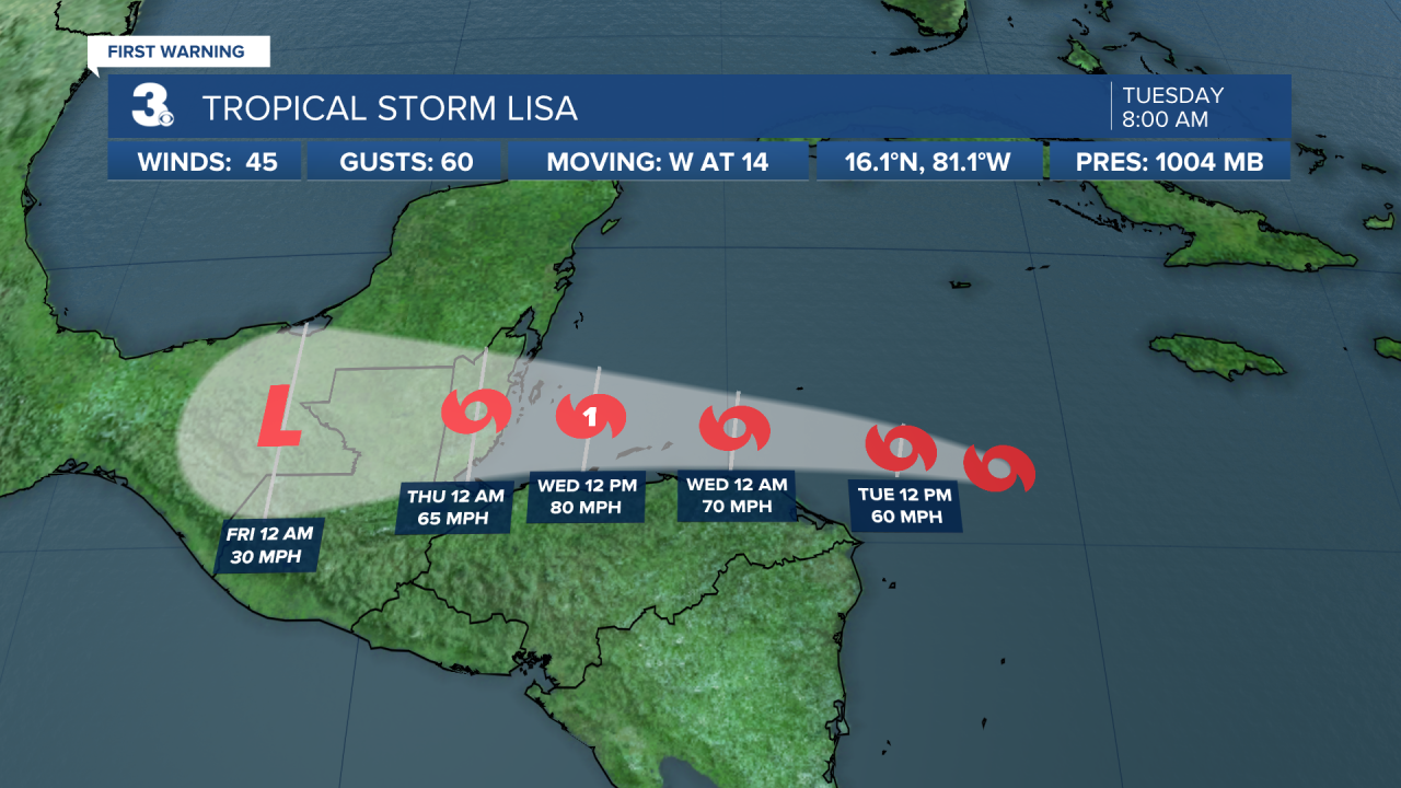
Tropical Storm Lisa is centered about 220 miles south of Grand Cayman and moving west. On the forecast track, the center will pass south of the Cayman Islands today, move near or over the Bay Islands of Honduras early on Wednesday, and approach Belize later Wednesday. Maximum sustained winds remain near 45 mph with higher gusts. Strengthening is expected, and Lisa is forecast to become a hurricane by early Wednesday over the northwestern Caribbean Sea.
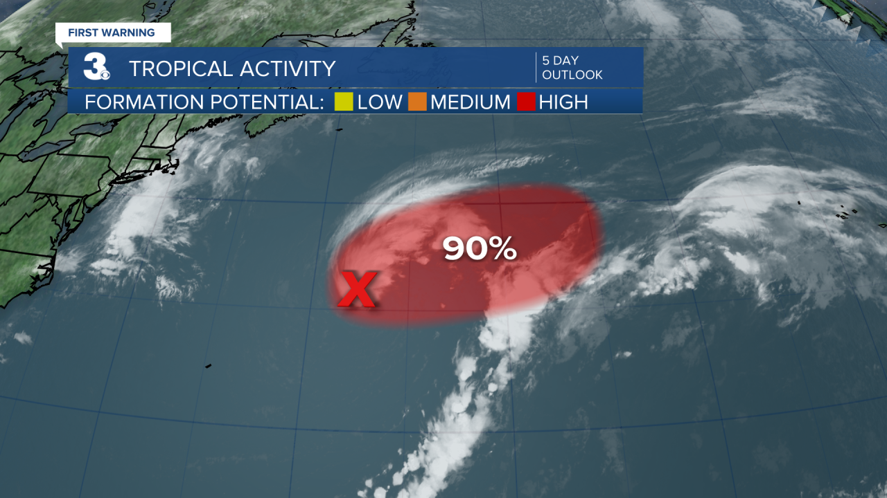
Shower and thunderstorm activity continues to show signs of organization in association with an area of low pressure located several hundred miles ENE of Bermuda. This low has been acquiring tropical characteristics during the last 24 hours, and environmental conditions appear conducive for additional development. The system is likely to become a tropical or subtropical storm later today while it moves generally ENE.
* Formation chance through 48 hours: High (90%)
* Formation chance through 5 days: High (90%)
Weather updates on social media:
Facebook: MylesHendersonWTKR
Twitter: @MHendersonWTKR
Instagram: @MylesHendersonWTKR
