Meteorologist Myles Henderson’s First Warning Forecast
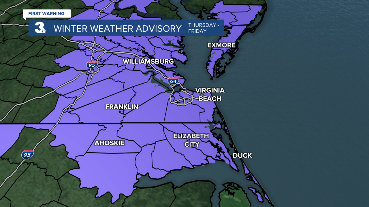
*** Winter Weather Advisory for all of eastern Virginia and most of northeast North Carolina from Thursday to Friday AM. About 1” of snow possible by Thursday night.
*** Winter Storm Watch for most of southeast Virginia and northeast North Carolina from Friday to Saturday morning. 5” to 10” of snow possible by Saturday morning.
Tracking two rounds of snow to end the week… Rain will move in with a cold front from mid-morning to midday with temperatures in the upper 40s. Rain will change over to snow (from NW to SE) this afternoon to evening as temperatures fall from the 40s to 30s. Minor snow accumulation is possible by Thursday night (near 1”). Wind will kick up this afternoon, north at 10 to 20 mph
A bigger chance for snow is expected Friday and Saturday as an area of low pressure slides up the East Coast. Most of the area will see snow with rain for the Outer Banks. The biggest chances will be Friday PM to Saturday AM. Significant snow accumulation is possible (4” to 8”). Highs will only reach the low 30s on Friday and mid 30s on Saturday. It will be windy with north winds at 10 to 20 and gusts to 30+ mph.
Sunday will be the better pick of the weekend with partly cloudy skies, lighter winds, and highs in the upper 30s. Watch out for refreeze overnight as temperatures drop to the 20s Saturday night and again Sunday night.
Today: AM Rain, PM Snow, Windy. Highs in the upper 40s. Winds: N 10-20
Tonight: Rain/Snow, Windy. Lows in the upper 20s. Winds: N 10-20G30
Tomorrow: Snow, Windy. Highs in the low 30s. Winds: N 15-25G35
Weather updates on social media:
Facebook: MylesHendersonWTKR
Twitter: @MHendersonWTKR
Instagram: @MylesHendersonWTKR