


Meteorologist Myles Henderson’s First Warning Forecast
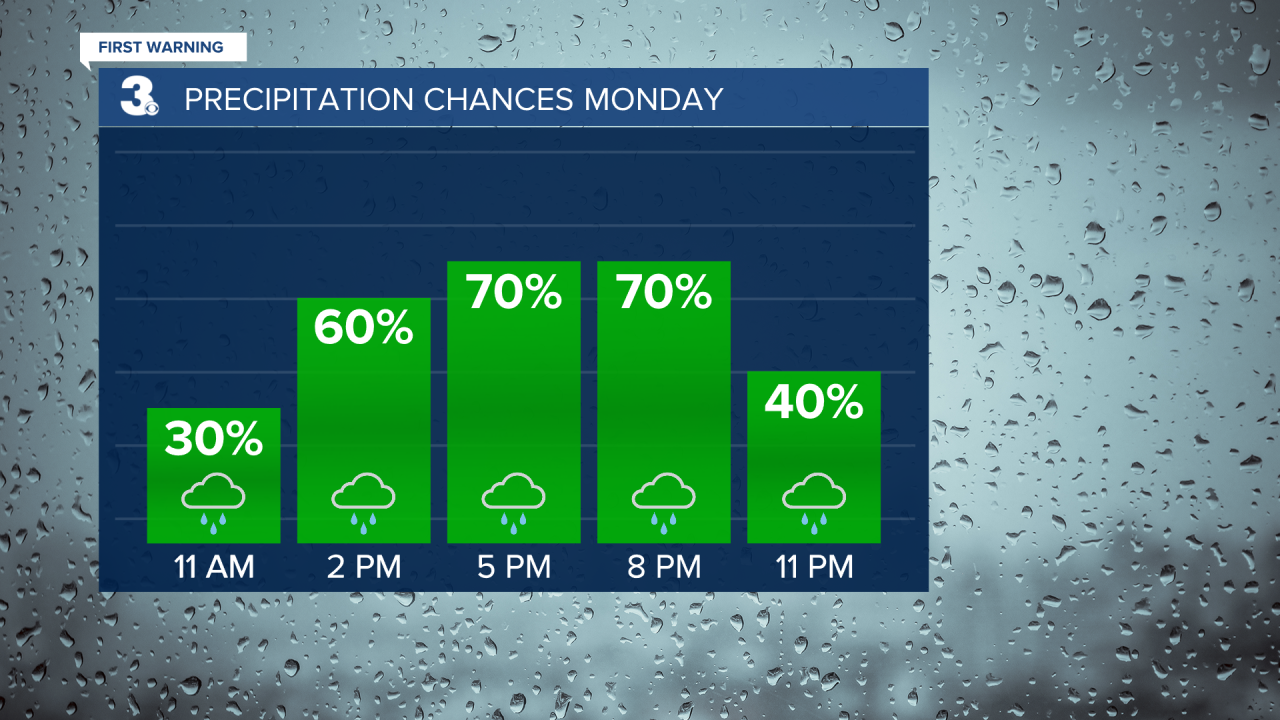
Another round of rain today… Expect mostly cloudy skies today with rain moving up the coast with an area of low pressure. We will see scattered showers this morning with rain becoming more widespread this afternoon to evening. Rain will move out tonight near midnight. Highs will warm to the mid 40s today with a slight north to NW wind.
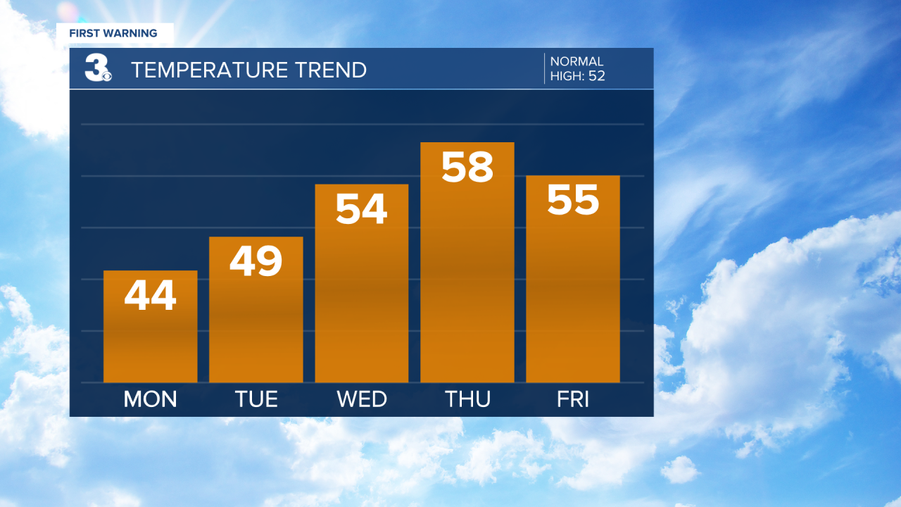
Look for clearing skies tomorrow, more clouds in the morning and more sunshine in the afternoon. Highs will warm to the upper 40s tomorrow. The second half of the week will be very nice. Expect sunny skies with highs in the mid to upper 50s Wednesday, Thursday, Friday, and even Saturday.
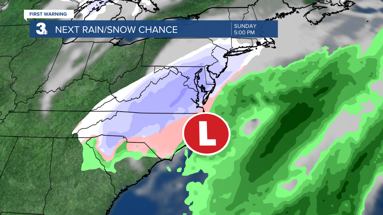
We are keeping a close eye on Sunday. A cold front is set to move through the region Saturday night to Sunday and an area of low pressure will track across the Southeast on Sunday. This could bring us another chance for a rain/snow mix to end the weekend. Obviously, a lot can change over the next several days, so be on the lookout for updates throughout the week.
Today: Mostly Cloudy, Rain. Highs in the mid 40s. Winds: N 5-15
Tonight: Mostly Cloudy, Showers. Lows in the mid 30s. Winds: NW 5-10
Tomorrow: Clearing Skies. Highs in the upper 40s. Winds: NW 5-10
Weather updates on social media:
Facebook: MylesHendersonWTKR
Twitter: @MHendersonWTKR
Instagram: @MylesHendersonWTKR
