


Meteorologist Myles Henderson’s First Warning Forecast
*** Tornado Watch until 3 PM Friday for most of SE VA and all of NE NC

The remnants of Nicole are spreading over the Mid-Atlantic today, bringing us showers, strong winds, and a severe threat. A big temperature drop is on the way this weekend.
The remnants of Nicole will move over the Mid-Atlantic today. Expect multiple rounds of scattered showers and storms as the outer bands of Nicole track through the region. The highest storm chances look to be through the early afternoon hours. Strong to severe storms are possible, including a risk for tornadoes. Winds will ramp up, mainly SE at 10 to 20 with gusts of 25 to 35 mph. Highs will warm to the mid 70s this afternoon.

Rain should move out overnight Friday and clouds will clear early Saturday as winds relax. Expect a nice mix of sun and clouds on Saturday with highs in the mid 70s.
A cold front will move through late Saturday to early Sunday. A few showers are possible, but much cooler air will move in. Highs will only reach the mid 50s on Sunday.

Highs will linger in the mid 50s for the first half of next week. Our next round of rain is set to move in Tuesday to Wednesday.
Today: Showers, Storms, Windy. Highs in the mid 70s. Winds: SE 10-20 G30
Tonight: Showers, Storms, Windy. Lows in the mid 60s. Winds: S 10-20G30
Tomorrow: Mix of Sun & Clouds. Highs in the mid 70s. Winds: W 5-15
Weather & Health
Pollen: Low (Ragweed)
UV Index: 2 (Low)
Air Quality: Good (Code Green)
Mosquitoes: Moderate
Tropical Update
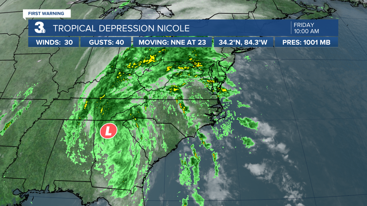
Tropical Depression Nicole is centered about 35 miles north of Atlanta, Georgia and moving NNE at 23 mph. On the forecast track, the center of Nicole will continue to move over the southern Appalachians during the next few hours. Maximum sustained winds are near 30 mph with higher gusts. Nicole is forecast to become a post-tropical cyclone later today and the remnants will continue to move northeast through Saturday morning.
Weather updates on social media:
Facebook: MylesHendersonWTKR
Twitter: @MHendersonWTKR
Instagram: @MylesHendersonWTKR
