

Meteorologist Tony Nargi's First Warning Forecast
Tonight showers and storms will taper off with mostly clear skies expected and lows dropping off into the upper 60s to low 70s.

Tomorrow will be similar to today with a humid start followed by showers and pop-up storms in the afternoon! We'll be a bit warmer with highs in the mid 80s, along with light winds out of the SW at 5-10 mph. Some isolated downpours could cause localized flooding. Surf height will be between 2-3 feet, with a moderate risk of rip currents.

Wednesday will continue the warming trend with highs reaching the upper 80s and heat indices in the upper 90s! Pop-up showers and storms will be possible once again along with winds out of the SW at 10-15 mph. We'll peak at around 90 by Thursday, with a heat index near 100! Showers and storms will taper off a bit as the week comes to an end, with a mainly dry weekend expected.

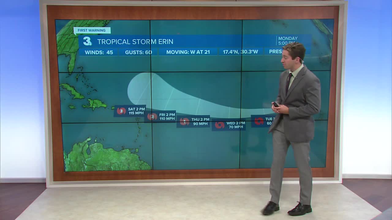
TRACKING THE TROPICS

Tropical Storm Erin has formed in the Central Atlantic and is moving west off the Cape Verde Islands. Erin is expected to trek west over the next several days, and as she moves closer to the Caribbean warmer waters should help her intensify. Erin is then expected to turn north of the Leeward Islands. Erin is still a long way from Hampton Roads, but we'll keep you updated on her track throughout the week!

Weather updates on social media:
