

Meteorologist Tony Nargi's First Warning Forecast
Today is the first day of fall! The autumnal equinox occurs at 2:19 pm. It will be pleasant with clear skies to start and partly cloudy skies this afternoon. Highs will reach the mid 70s to low 80s. Winds will be out of the NE at 5-10 mph. Tonight, temperatures fall into the 50s to mid 60s.

Tomorrow will be nice again, we'll see mostly sunny skies, along with light winds out of the S at 5-10 mph. Temperatures climb later this week, with 80s tomorrow and mid to upper 80s by Wednesday and Thursday.


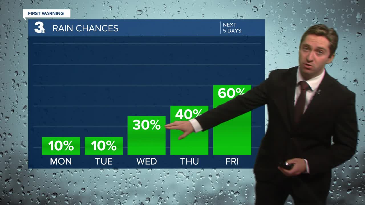
Mainly dry conditions are expected through tomorrow. The chance of storms increases Wednesday, with widespread showers and storms possible Thursday afternoon and all day Friday as a cold front moves through. Dew points will also be on the rise, with dew points in the 60s today jumping to the low 70s by Wednesday.

TRACKING THE TROPICS

Hurricane Gabrielle is expected to strengthen today, and is currently a category 1 Hurricane. We will see little to no impacts as Hurricane Gabrielle moves out to sea and east towards the Azores later this week.

Two areas of concern need to be monitored in the Atlantic. One area likely to develop over the next week is moving across the Central Atlantic has a 60% chance of development, another area further west close to the leeward islands has a 30% chance of development over the next week. The area with a 30% chance of development would pose the biggest threat to the US. Right now its still nothing more than a cluster of thunderstorms that needs to be monitored, we'll keep you updated throughout this week.
Weather updates on social media:
