


Meteorologist Myles Henderson’s First Warning Forecast
Several days in the 70s. Tracking rain and a threat for severe storms for midweek. Trending cooler this weekend.
We will start with sunshine this morning, but clouds will build in through the day. Highs will reach the low to mid 70s this afternoon, about 10 degrees above normal for this time of year.

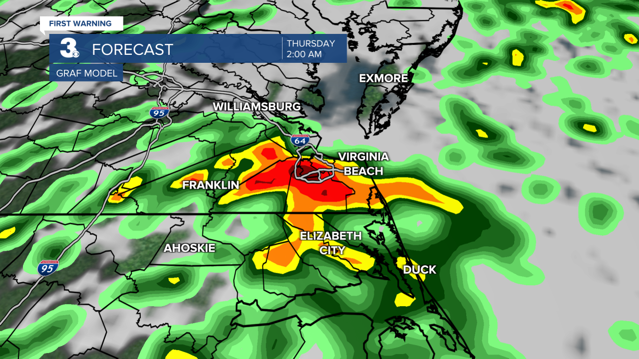
Our next rain maker (a cold front) is set to move in Wednesday to Thursday. Expect mostly cloudy skies Wednesday with a few scattered showers during the day. Rain and storm chances will increase Wednesday night to Thursday morning. Strong to severe thunderstorms are possible, including damaging wind gusts, localized flooding, pockets of hail, and isolated tornadoes. Rain and storms will continue Thursday. Rain chances will be higher in the morning to midday and dropping by the afternoon to evening. It will still be warm with highs in the low 70s both days.
We will get a chance to dry out on Friday with highs falling to the mid 60s with partly cloudy skies. Even cooler air is set to move in this weekend with highs in the low 60s on Saturday and mid 50s on Sunday.
Today: AM Sun, PM Clouds. Highs in the mid 70s. Winds: SW/N 5-10
Tonight: Partly Cloudy. Lows near 50. Winds: E/S 5-10
Tomorrow: Mostly Cloudy, Scattered Showers. Highs in the low 70s. Winds: SE 5-15
Weather & Health
Pollen: High (Juniper, Birch, Sycamore)
UV Index: 6 (High)
Air Quality: Good (Code Green)
Mosquitoes: Low
Weather updates on social media:
Facebook: MylesHendersonWTKR
Twitter: @MHendersonWTKR
Instagram: @MylesHendersonWTKR
