


Meteorologist Myles Henderson’s First Warning Forecast
A taste of summer with several days in the 90s. Tracking showers and storms for Thursday and Friday. Cooler and less humid this weekend.
Expect mostly sunny skies today with highs in the low 90s, about 10 degrees above normal for this time of year. Highs will return to the low 90s on Wednesday with mostly sunny to partly cloudy skies. A stray shower/storm is possible but overall chances will be slim.
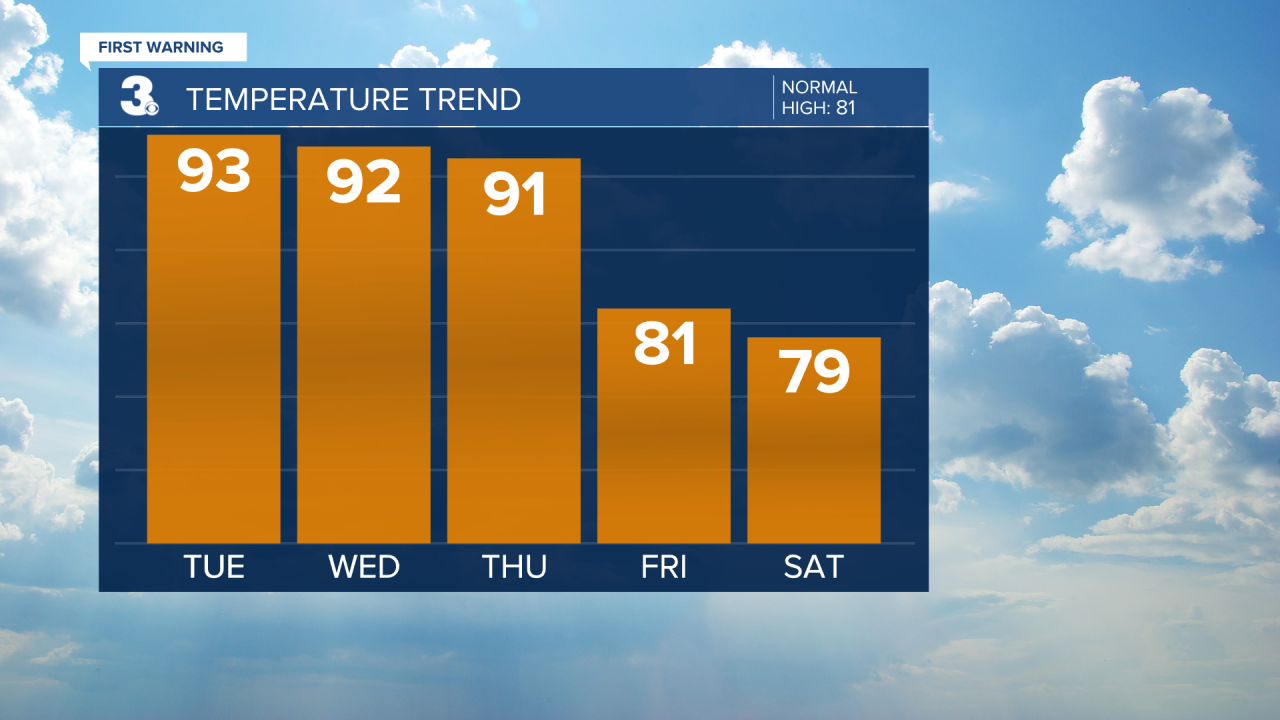
More rain and storms will move in for the end of the work week with a cold front. Scattered showers and storms are expected Thursday evening. Strong to severe thunderstorms are possible with a higher risk to the north and lower risk to the south. Scattered showers and storms will linger for Friday. Temperatures will also drop behind the front, from the low 90s on Thursday to the low 80s on Friday.

The upcoming weekend is looking nice but cooler. We should see partly cloudy skies with slim rain chances. Highs will dip to the upper 70s with lower humidity.
Today: Mostly Sunny. Highs in the low 90s. Winds: W/N/E 5-10
Tonight: Mainly Clear. Lows in the low 70s. Winds: S 5-10
Tomorrow: A Few Clouds. Highs in the low 90s. Winds: W/N//S 5-10
Weather & Health
Pollen: Medium (Grasses, Oak, Hickory)
UV Index: 9 (Very High)
Air Quality: Moderate (Code Yellow)
Mosquitoes: Very High
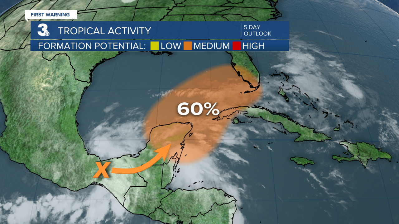
Tropical Update
A large and complex area of low pressure is expected to develop near the Yucatan Peninsula and the northwestern Caribbean Sea in a couple of days, partially related to the remnants of Agatha from the eastern Pacific. Despite strong upper-level winds over the area, this system could become a tropical depression while it moves northeast over the northwestern Caribbean Sea and southeastern Gulf of Mexico late this week.
* Formation chance through 48 hours: Low (10%)
* Formation chance through 5 days: Medium (60%)
Weather updates on social media:
Facebook: MylesHendersonWTKR
Twitter: @MHendersonWTKR
Instagram: @MylesHendersonWTKR
