


Meteorologist Myles Henderson’s First Warning Forecast
Warming back to the 70s with rain and storm chances through midweek. Cooling to the 60s again this weekend.
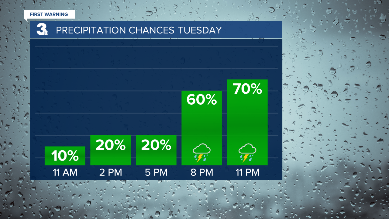
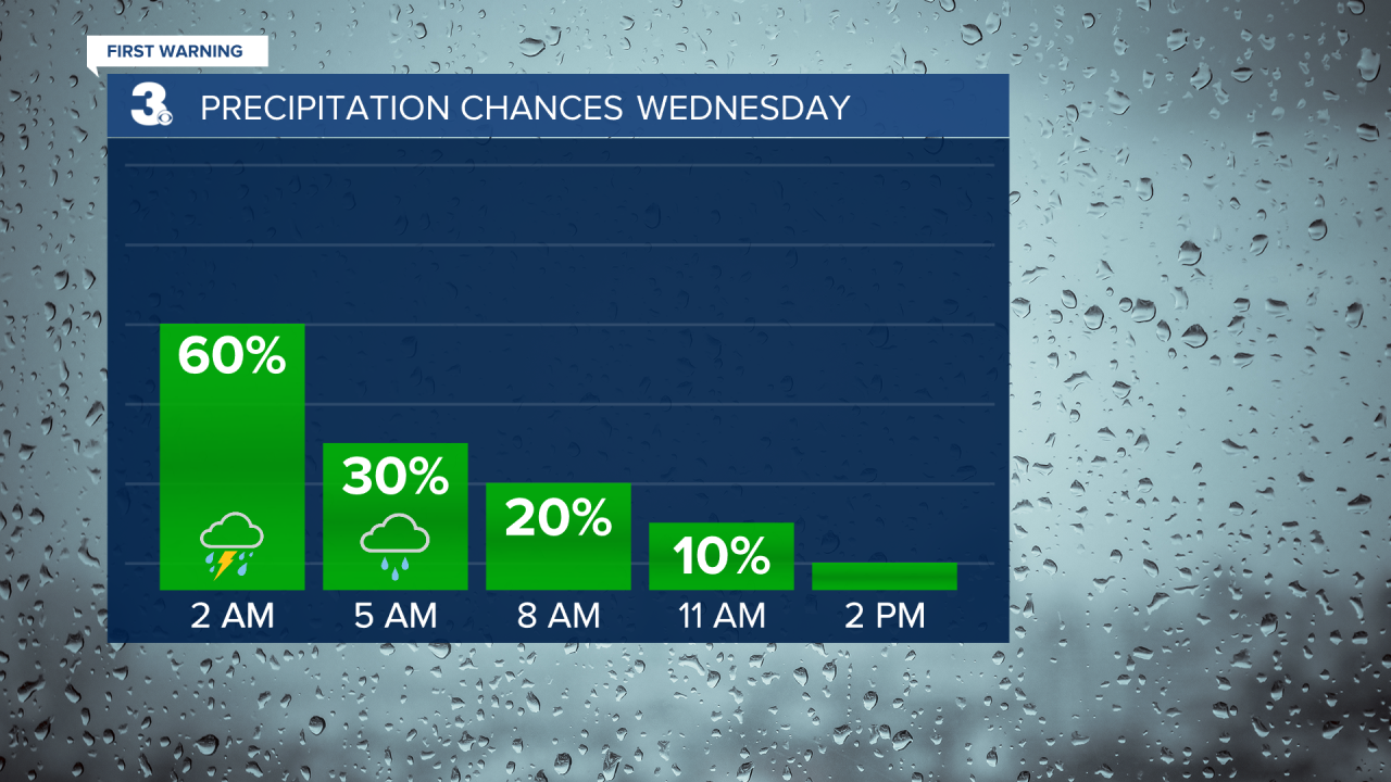
We will climb to the mid 70s this afternoon, 15 to 20 degrees warmer than yesterday. Expect partly to mostly cloudy skies today with rain moving in late. A few showers are possible during the day, but the biggest chance will be tonight to early Wednesday morning (8 PM to 5 AM). An isolated thunderstorm is possible with the biggest storm threat in North Carolina.
Showers will taper off Wednesday morning and clouds will clear out by midday. Expect mostly sunny skies with highs in the mid 70s tomorrow afternoon.
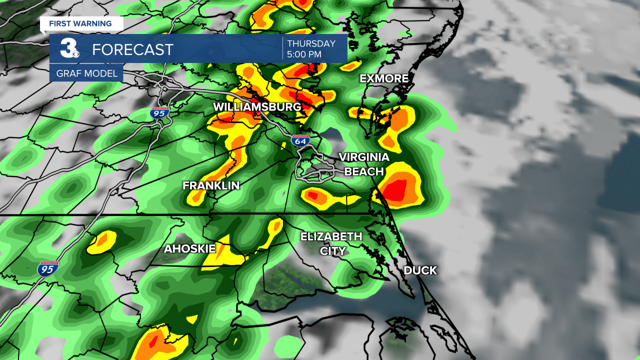
Another round of rain and storms is set to move in on Thursday with a cold front. The biggest chance will be Thursday afternoon to evening (3 PM to 8 PM). Strong to severe thunderstorms are possible.
Highs will drop to the 60s for Friday and the weekend. Expect partly cloudy skies with a few lingering showers possible (20% chance) Friday and Saturday. More sunshine will mix in for Sunday.
Today: Partly to Mostly Cloudy. Highs in the mid 70s. Winds: S 5-15
Tonight: Mostly Cloudy, Rain. Lows in the low 60s. Winds: S 10-15
Tomorrow: Clearing Skies. Highs in the mid 70s. Winds: W 10-15
Weather & Health
Pollen: Medium-High (Maple, Juniper, Birch)
UV Index: 7 (High)
Air Quality: Good (Code Green)
Mosquitoes: Low
Weather updates on social media:
Facebook: MylesHendersonWTKR
Twitter: @MHendersonWTKR
Instagram: @MylesHendersonWTKR
