


Meteorologist Myles Henderson’s First Warning Forecast
Building heat and humidity to end the week. Storm chances linger through the weekend.
Building more heat and humidity for the second half of the week. Highs will reach the low 90s today with an afternoon heat index of 100 to 105. Expect a mix of sun & clouds with “pop up” showers/storms possible, mainly in the afternoon.

Highs will climb to the mid 90s on Thursday with an afternoon heat index over 105. Expect partly cloudy skies with a small chance for a shower or storm.
More of the same for Friday with highs in the mid 90s and a heat index over 105. An afternoon “pop up” shower or storm is possible.

This trend continues for the weekend. Expect highs in the low 90s with a heat index in the lower triple digits. Scattered showers and storms are likely, mainly in the afternoons.
Today: Afternoon Storms. Highs in the low 90s. Winds: SW 5-15
Tonight: Partly Cloudy. Lows in the upper 70s. Winds: SW 5-15
Tomorrow: Hot & Humid. Highs in the mid 90s. Winds: SW 10-20
Weather & Health
Pollen: Low-Medium (Grasses)
UV Index: 7 (High)
Air Quality: Good (Code Green)
Mosquitoes: Extreme
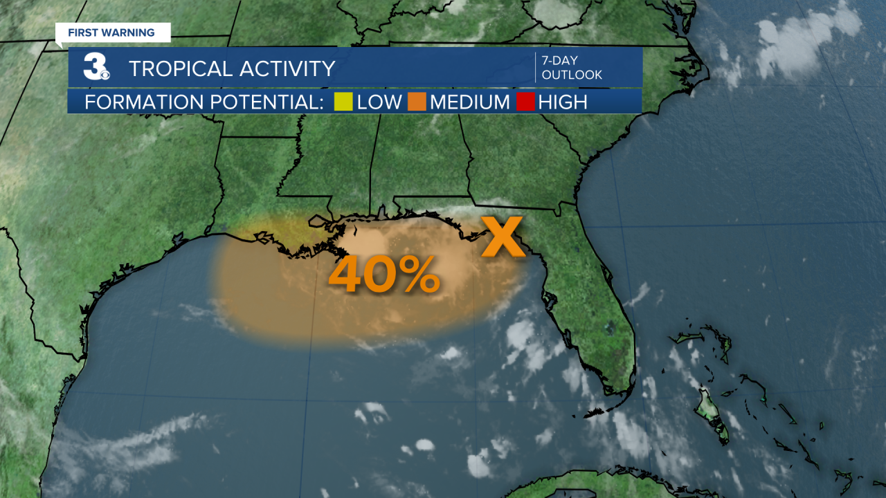
Tropical Update
Tracking a broad area of low pressure moving across the Florida Panhandle. This system is forecast to continue moving west and could emerge or redevelop over the northern portion of the Gulf, reaching the coast of Louisiana by Thursday. If this system moves far enough offshore, environmental conditions over the Gulf appear generally favorable for additional development, and a tropical depression could form over the next couple of days before the system moves fully inland by the end of the week.
* Formation chance through 48 hours: Medium (40%)
* Formation chance through 7 days: Medium (40%)
Weather updates on social media:
Facebook: MylesHendersonWTKR
Instagram: @MylesHendersonWTKR
