


Meteorologist Myles Henderson’s First Warning Forecast
Back-to-back rain chances for the second half of the work week. We will see some wild temperature swings (20+ degrees) between passing fronts.
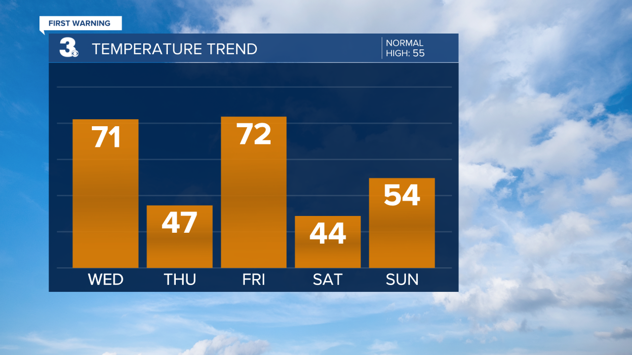
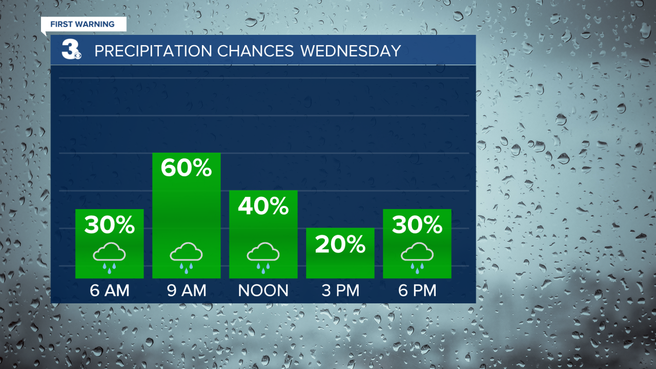
Another warm morning with temperatures in the 60s. We will climb back to near 70 this afternoon, about 15 degrees above normal for this time of year. Expect mostly cloudy skies today with scattered showers, mainly mid-morning to midday. It will be breezy today with SW winds at 10 to 15 mph.
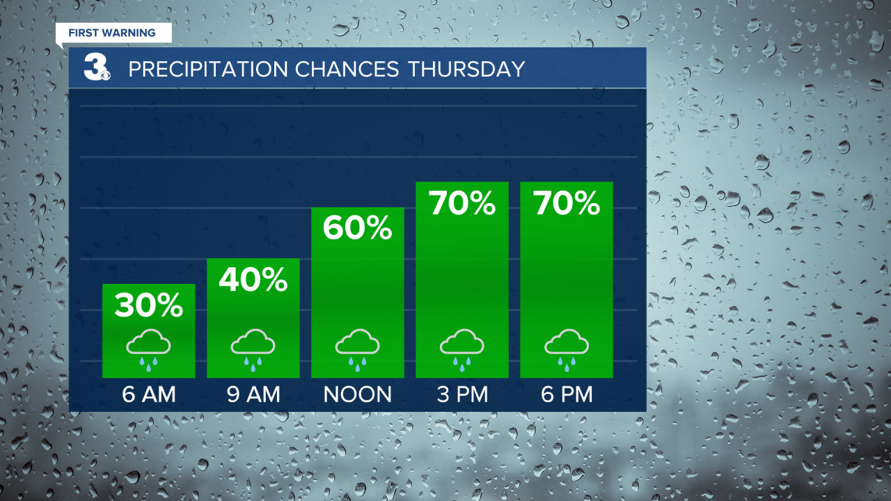
A second wave of rain will move through Thursday with the biggest rain chances in the afternoon to early evening. It will be much cooler tomorrow with highs only in the mid 40s. It will still be breezy with NE winds at 10 to 15 mph.
We will warm back to the 70s on Friday before a third wave of rain moves in with a cold front. It will be windy Friday with SW winds 10 to 20 mph.
Cold air will return this weekend with highs in the mid 40s and lows in the 30s. Expect partly cloudy skies on Saturday with another rain chance on Sunday. Highs will warm to the mid 50s on Sunday, closer to normal for this time of year.
Today: Mostly Cloudy, Scattered Showers, Breezy. Highs near 70. Winds: SW 10-15
Tonight: Mix of Clouds, Spotty Showers. Lows in the mid 40s. Winds: N 5-15
Tomorrow: Mostly Cloudy, Showers, Breezy. Highs in the mid 40s. Winds: NE 10-15
Weather updates on social media:
Facebook: MylesHendersonWTKR
Twitter: @MHendersonWTKR
Instagram: @MylesHendersonWTKR
