


Meteorologist Myles Henderson’s First Warning Forecast
A very summer-like end to the week with heat, humidity, and storms. There is a risk for severe thunderstorms today and tomorrow.
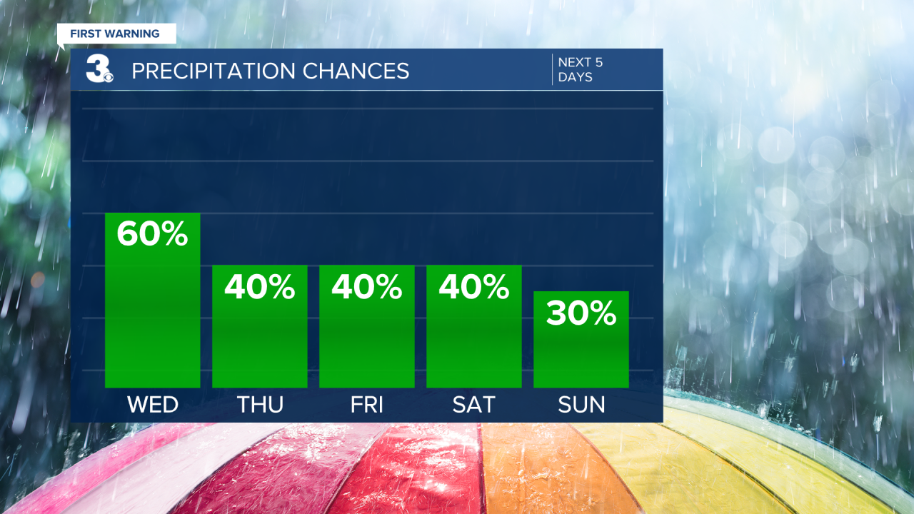
Another hot and humid day with highs in the low 90s. Afternoon heat index values will reach the mid and upper 90s. We will start with sunshine this morning, but clouds will build through the day. Scattered showers and storms will fire up this afternoon. Strong to severe storms are possible with damaging wind gusts and localized flooding.
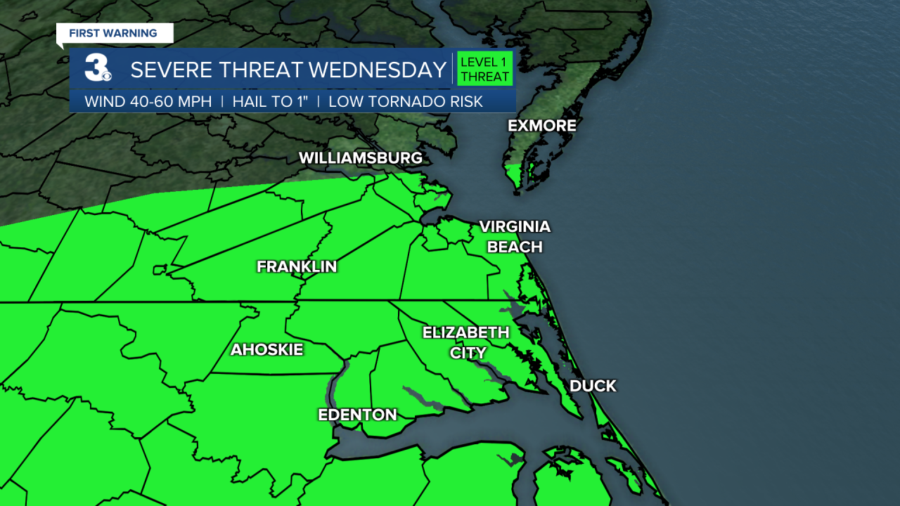
Expect a mix of partly to mostly cloudy skies tomorrow with lingering showers and storms. Strong to severe storms are possible, mainly in NC. Highs will dip to the upper 80s tomorrow, but it will still be humid.

We will be stuck in an unsettled pattern for the end of the week as a stationary front lingers over the Mid-Atlantic. Expect a mix of sun and clouds with scattered showers and storms for Friday and this weekend. Highs will linger in the mid to upper 80s and it will still be muggy.
Today: AM Sun, PM Storms. Highs in the low 90s. Winds: W/S 5-10
Tonight: Mostly Cloudy, Scattered Showers/Storms. Lows in the mid 70s. Winds: SW 5-10
Tomorrow: Mix of Clouds, Scattered Showers/Storms. Highs in the upper 80s. Winds: SW 5-10
Weather & Health
Pollen: Low-Medium (Grasses)
UV Index: 9 (Very High)
Air Quality: Good (Code Green)
Mosquitoes: Very High
Tropical Update
A surface trough extending from the Florida Panhandle along the northern Gulf coast continues to produce disorganized showers and thunderstorms over the northern Gulf of Mexico. The surface trough is forecast to drift north during the next few days and significant development is unlikely due to the system's proximity to land.
* Formation chance through 48 hours: Low (10%)
* Formation chance through 5 days: Low (10%)
Weather updates on social media:
Facebook: MylesHendersonWTKR
Twitter: @MHendersonWTKR
Instagram: @MylesHendersonWTKR
