


Derrah Getter's First Warning Forecast
This evening will be warm and comfortable. Lows fall into the low 60s tonight.
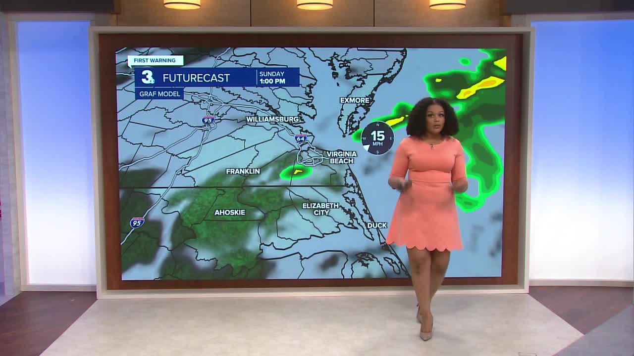
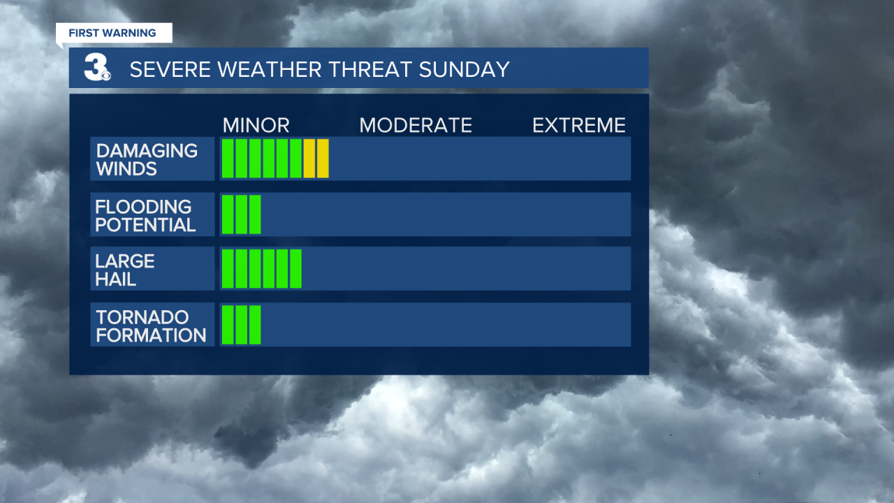
Skies will be mostly cloudy by Sunday morning. A few isolated showers will be possible in the morning with scattered storms in the afternoon and evening. Most of the area is under a level 1 out of 5 severe weather threat. Isolated damaging wind gusts and hail are possible.
Temperatures warm up through the middle of next week. Several days will be in the 70s and 80s. We could be flirting with a record high on Wednesday.
Another cold front crosses the region on Thursday, bringing scattered showers and cooler temperatures. Highs fall to the 50s and 60s on Friday and Saturday.

Let's connect on social media!
Forecaster Derrah Getter:
For weather updates on Facebook: HERE
For weather updates on X: HERE
Follow me on Instagram: HERE
Check out the Interactive Radar on WTKR.com: Interactive Radar
