


Meteorologist Myles Henderson’s First Warning Forecast
*** Tornado Watch until 6 PM Friday for a good portion of SE VA and most of NE NC.

Keeping an eye on the storms moving through today. More sunshine and several days in the 80s for Memorial Day weekend.
Showers and storms will move through this afternoon to early evening with a cold front. Strong to severe storms are expected with damaging wind gusts, localized flooding, pockets of hail, and isolate tornadoes possible. Winds will ramp up as the cold front moves in, south at 10 to 20 with gusts to 30 mph. Highs will warm to the mid 80s today.
The warmer temperatures will stick around for Memorial Day weekend with highs in the low to mid 80s. Expect a mix of mostly sunny to partly cloudy skies this weekend with a stray shower/storm possible. Highs will warm to the mid and upper 80s on Monday with more sunshine. Expect several days in the low 90s next week.
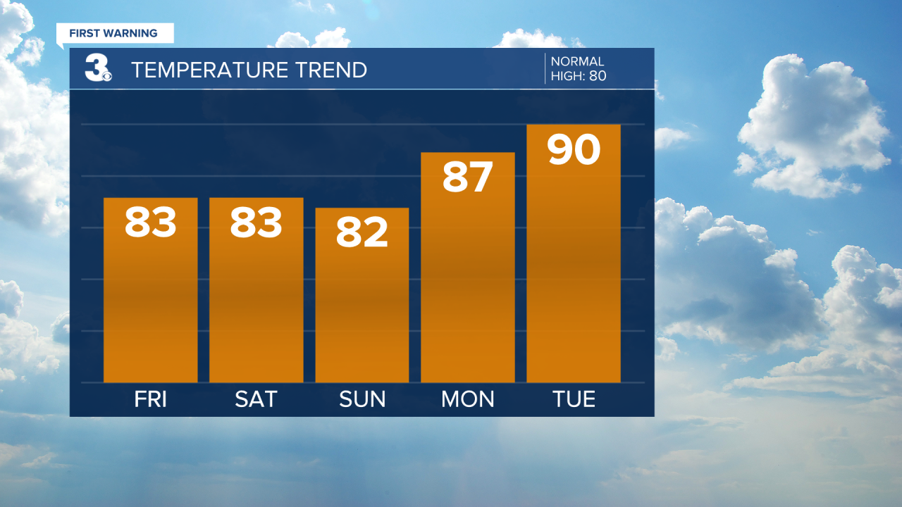
Today: Severe Threat, Windy. Highs in the mid 80s. Winds: S 10-20G30
Tonight: Scattered Storms, Windy. Lows in the upper 60s. Winds: SW 5-15
Tomorrow: Partly Cloudy. Highs in the mid 80s. Winds: W 5-10
Weather & Health
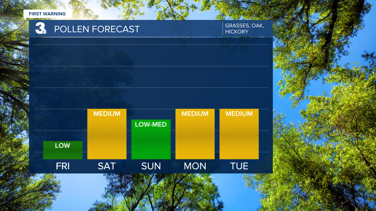
Pollen: Low (Grasses, Oak, Hickory)
UV Index: 6 (High)
Air Quality: Good (Code Green)
Mosquitoes: High
Today in Weather History (NWS Wakefield)
May 27th
1957 Tornado: Norfolk
Weather updates on social media:
Facebook: MylesHendersonWTKR
Twitter: @MHendersonWTKR
Instagram: @MylesHendersonWTKR
