


Meteorologist Myles Henderson’s First Warning Forecast
One more hot and humid day with a threat for severe storms. Cooler and less humid this weekend.
Another hot and humid day with highs in the mid 90s, 10 to 15 degrees above normal for this time of year. Expect mostly sunny to partly cloudy skies with showers and storms firing up this afternoon to evening. "Pop-up" showers and storms will start this afternoon. Storms will move in from west to east with a cold front this evening and tonight (8 PM to midnight). Strong to severe thunderstorms are possible with damaging wind gusts, localized flooding, and pockets of hail.

Cooler air will move in starting Friday with highs in the low 80s. It will still be muggy Friday morning, but the humidity will drop through the day. Expect a mix of clouds tomorrow with a few leftover showers possible.
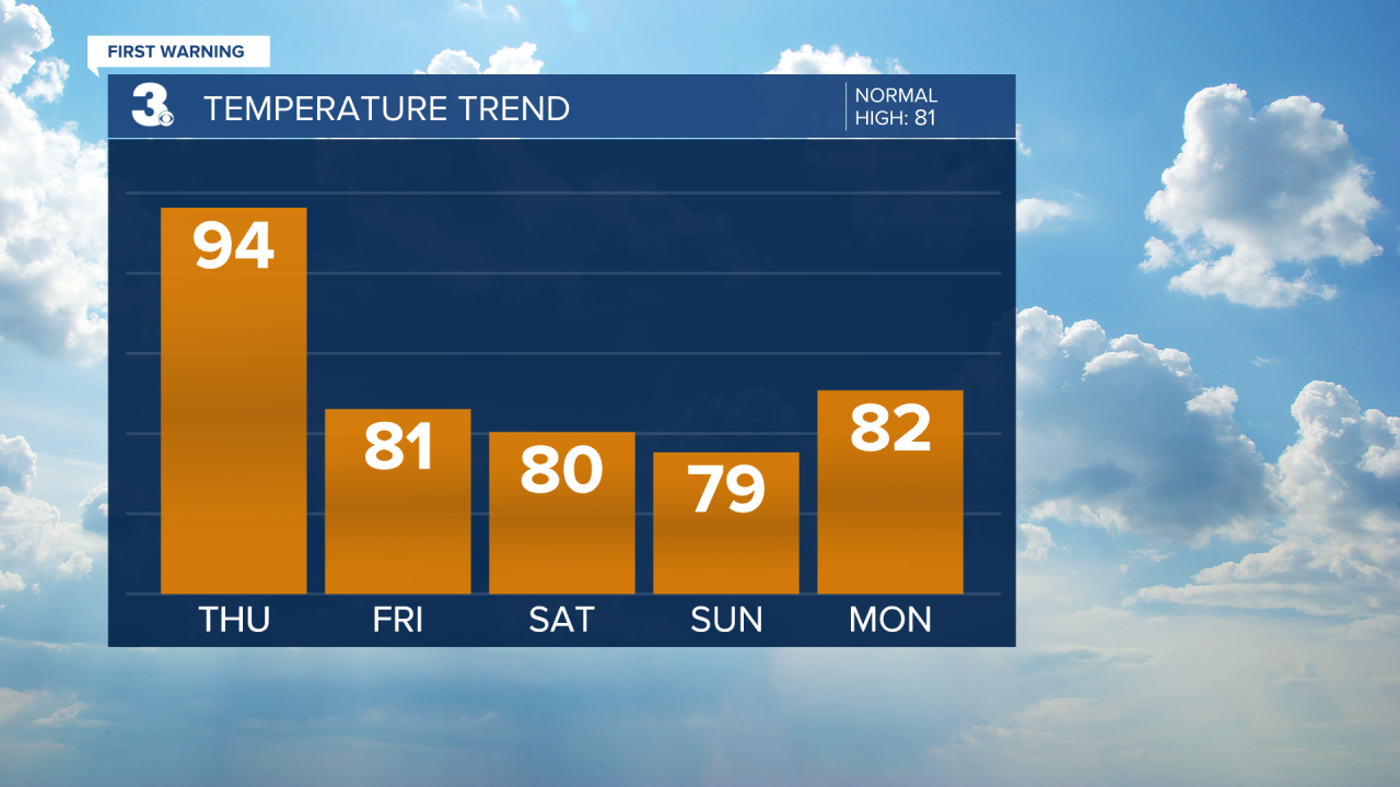
It will feel a bit more like spring this weekend. Highs will dip to the upper 70s and low 80s with lower humidity. We will see partly cloudy skies with slim rain chances.
Today: Sun & Clouds, Afternoon Storms. Highs in the mid 90s. Winds: SW/W 5-10
Tonight: Scattered Storms. Lows in the low 70s. Winds: W 5-10
Tomorrow: Mix of Clouds, Spotty Showers. Highs in the low 80s. Winds: N 5-15
Weather & Health
Pollen: Medium (Grasses, Oak, Hickory)
UV Index: 10 (Very High)
Air Quality: Moderate (Code Yellow)
Mosquitoes: Extreme
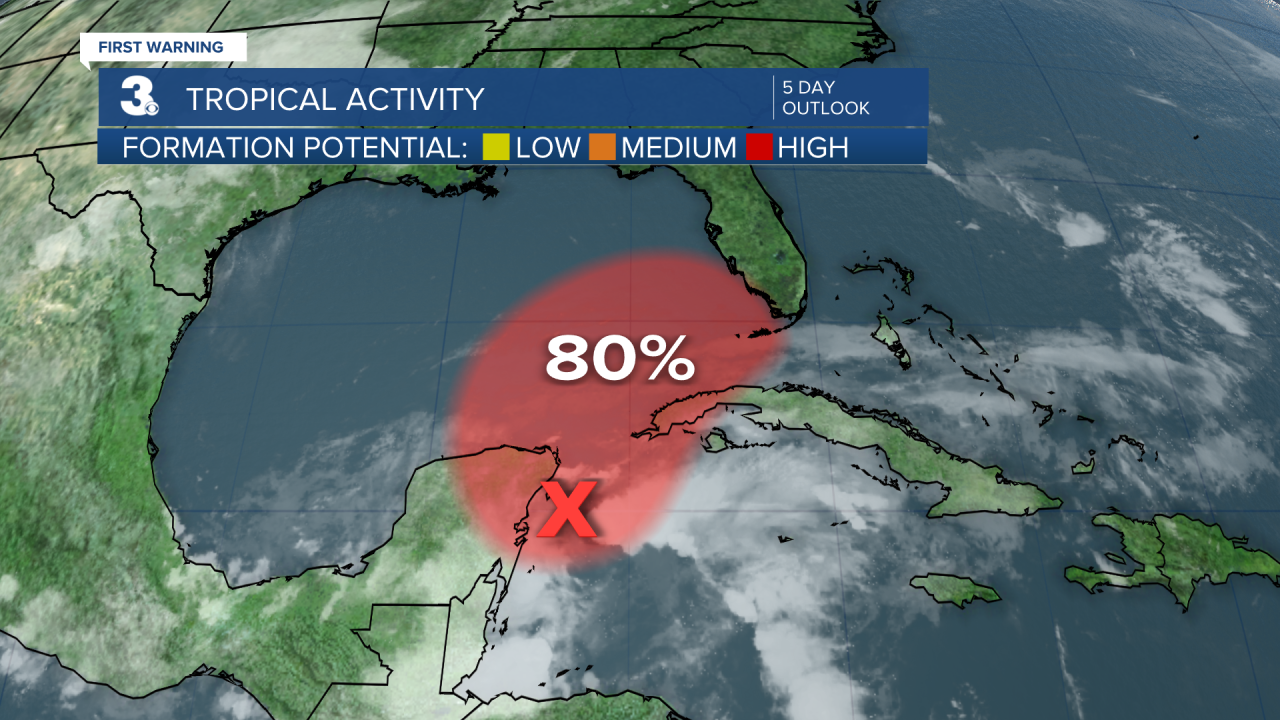
Tropical Update
A broad area of low pressure located near the east coast of the Yucatan Peninsula continues to produce a large area of disorganized showers and thunderstorms over the northwestern Caribbean Sea and Yucatan Peninsula. Despite strong upper-level winds, this system is likely to become a tropical depression or tropical storm while it moves slowly northeast over the northwestern Caribbean Sea and southeastern Gulf of Mexico during the next day or two.
* Formation chance through 48 hours: High (80%)
* Formation chance through 5 days: High (80%)
Weather updates on social media:
Facebook: MylesHendersonWTKR
Twitter: @MHendersonWTKR
Instagram: @MylesHendersonWTKR
