


Meteorologist Myles Henderson’s First Warning Forecast
Multiple chances for severe thunderstorms to wrap up the week. A mostly dry start to next week.
We will see some clearing skies through the afternoon hours. It will feel a little more like summer today with highs in the low 80s and increased humidity.
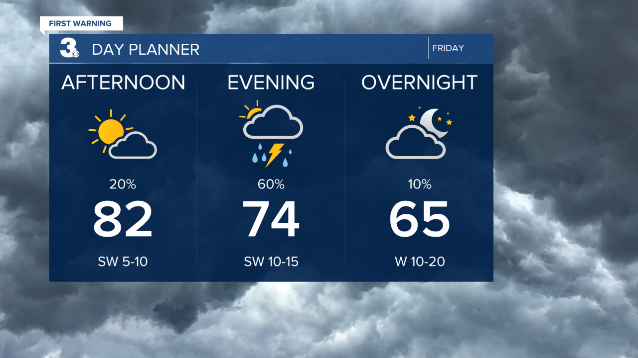
Scattered showers and storms will move in this evening to tonight. Severe storms are possible with a risk for damaging wind gusts, hail, localized flooding, and isolated tornadoes.

Looking like a bit of a 50/50 weekend. Scattered showers and storms will return for Saturday, mainly in the afternoon to evening. Severe storms are possible, and it will be windy on Saturday.

We will see more sunshine, lower rain chances, and light winds on Sunday. Highs will return to the upper 70s through the weekend with falling humidity.
Rain chances will remain low for the start of next week. Highs will climb from the upper 70s to the upper 80s with building humidity.
Today: AM Rain, Mix of Clouds. Highs in the low 80s. Winds: SW 5-10
Tonight: Scattered Showers/Storms. Lows in the low 60s. Winds: SW 10-15
Tomorrow: Afternoon Showers/Storms. Highs in the upper 70s. Winds: W 10-20
Weather & Health
Pollen: Low (Grasses, Trees)
UV Index: 8 (High)
Air Quality: Good (Code Green)
Mosquitoes: High
Weather updates on social media:
Facebook: MylesHendersonWTKR
Instagram: @MylesHendersonWTKR
