


Meteorologist Myles Henderson’s First Warning Forecast
*** Heat Advisory from 11 AM to 7 PM Tuesday.

Hot and humid again day with a threat for severe storms. Tracking another round of storms on Friday with a cold front. Cooler and less humid this weekend.
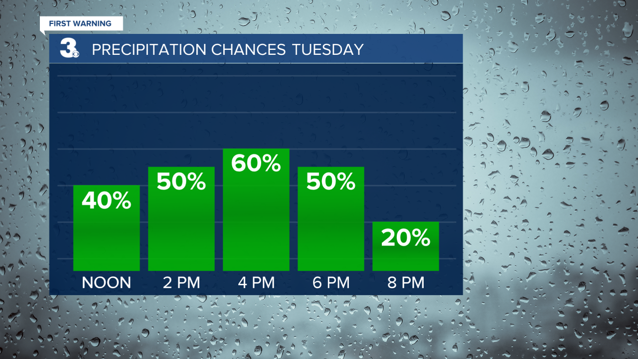
Another hot and humid day with highs in the low 90s and an afternoon heat index in near 100. Expect partly to mostly cloudy skies today with showers and storms this afternoon. The biggest chance for storms will be between 1 PM and 6 PM. Some storms could be strong to severe with the risk for damaging wind gusts, localized flooding, hail, and tornadoes.
We will see a slight break in the heat and humidity for Wednesday and Thursday. Highs will dip to the upper 80s with partly cloudy skies.
Rain and storms will return on Friday as a cold front moves through the region. Expect showers and storms mainly Friday afternoon to evening. The cold front will also bring in a temperature and humidity drop, from the mid 90s Friday to the low 80s this weekend.

Today: Hot & Humid, Severe Storms. Highs in the low 90s. Winds: SW/NW 5-15
Tonight: Partly Cloudy, Muggy. Lows in the low 70s. Winds: NE 5-10
Tomorrow: Partly Cloudy. Highs in the mid 80s. Winds: NE/E 5-10
Weather & Health
Pollen: Medium (Grasses)
UV Index: 6 (High)
Air Quality: Good (Code Green)
Mosquitoes: Extreme
Tropical Update
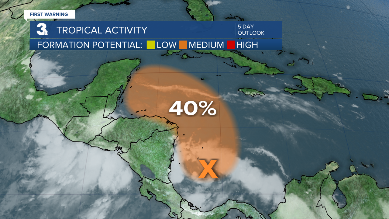
Disorganized showers and thunderstorms over the southwestern Caribbean Sea are associated with a trough of low pressure. Gradual development is possible while it drifts northwest near the coasts of Nicaragua and Honduras, and it could become a tropical depression late this week if the disturbance remains over water.
* Formation chance through 48 hours: 20%
* Formation chance through 5 days: 40%
Weather updates on social media:
Facebook: MylesHendersonWTKR
Twitter: @MHendersonWTKR
Instagram: @MylesHendersonWTKR
