


Meteorologist Myles Henderson’s First Warning Forecast
A threat for severe thunderstorms today. Get ready for a hot and humid week ahead with highs in the 80s and 90s. A few days will feel like 100+!
Keep your umbrella close if you’re out and about today. We will see a mix of partly to mostly cloudy skies with scattered showers and storms throughout the day. Some storms could be strong to severe with damaging wind gusts, localized flooding, hail, and even tornadoes possible. Highs will warm to the mid 80s today and humidity will return.

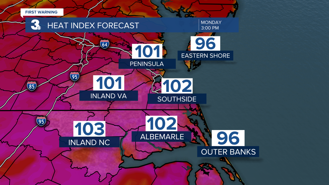
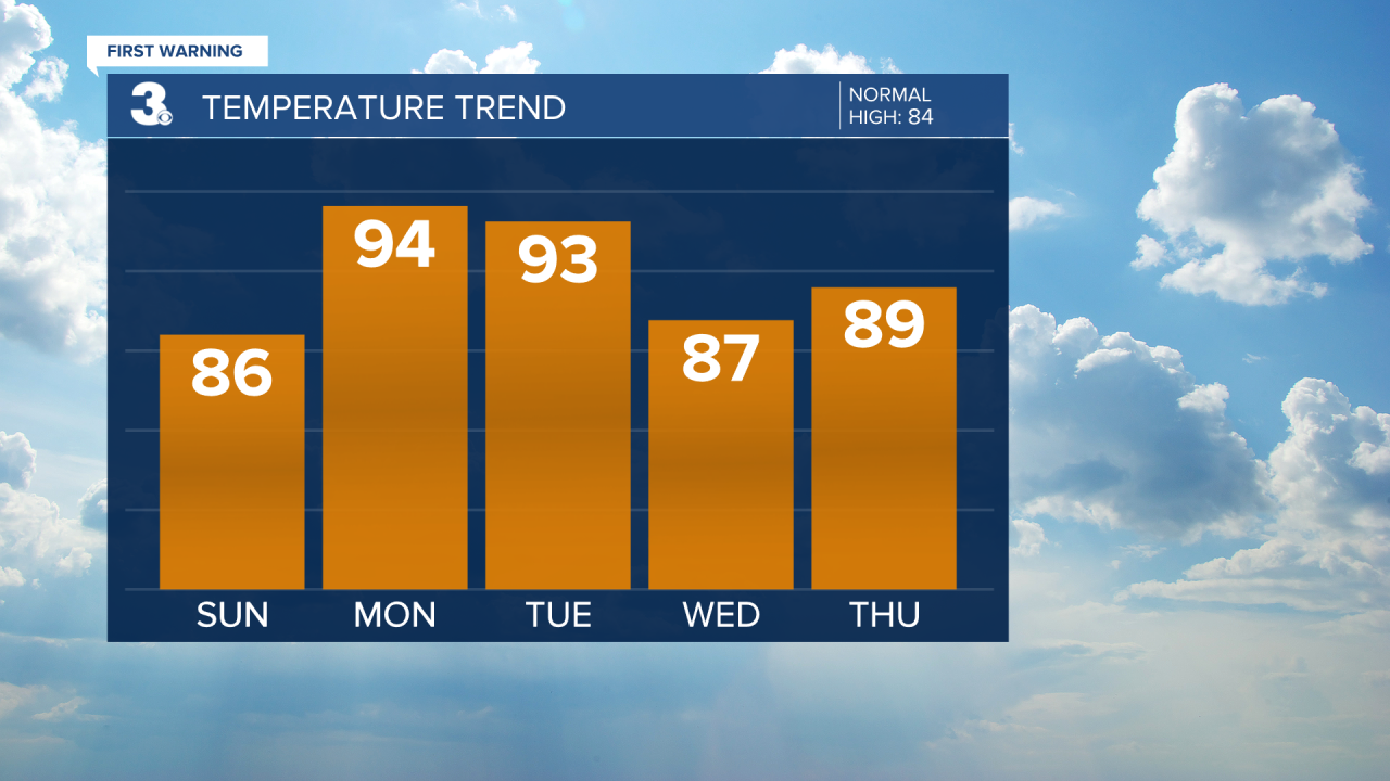
The summer-like heat and humidity locks in next week. We will see highs in the mid 90s on Monday with an afternoon heat index 100 to 105. Expect a mix of sun and clouds with scattered showers/storms firing up in the afternoon.
Tuesday will be very similar to Monday. Highs in the 90s with a heat index in the triple digits. A mix of sun and clouds with showers and storms firing up in the afternoon. Some storms could be severe on Tuesday.
We will see a slight break in the heat and humidity on Wednesday. Highs will dip to the upper 80s. Rain and storms will return on Friday as a cold front moves through the region.
Today: Mix of Clouds, Scattered Storms. Highs in the mid 80s. Winds: SE 5-15
Tonight: Partly Cloudy, Muggy. Lows in the low 70s. Winds: S 5-10
Tomorrow: Partly Cloudy, Scattered Storms. Highs in the mid 90s. Winds: SW 5-10
Weather & Health
Pollen: Low-Medium (Grasses)
UV Index: 4 (Moderate)
Air Quality: Good (Code Green)
Mosquitoes: Very High
Tropical Update
An area of low pressure is expected to develop by the middle part of this week over the southwestern Caribbean Sea. Some slow development is possible while it drifts generally northwest off the coasts of Nicaragua and Honduras.
* Formation chance through 48 hours: Low (0%)
* Formation chance through 5 days: Low (20%)
Weather updates on social media:
Facebook: MylesHendersonWTKR
Twitter: @MHendersonWTKR
Instagram: @MylesHendersonWTKR
