First Warning Forecast:
After another afternoon of intense heat and severe storms, we'll get a break from both on Wednesday.
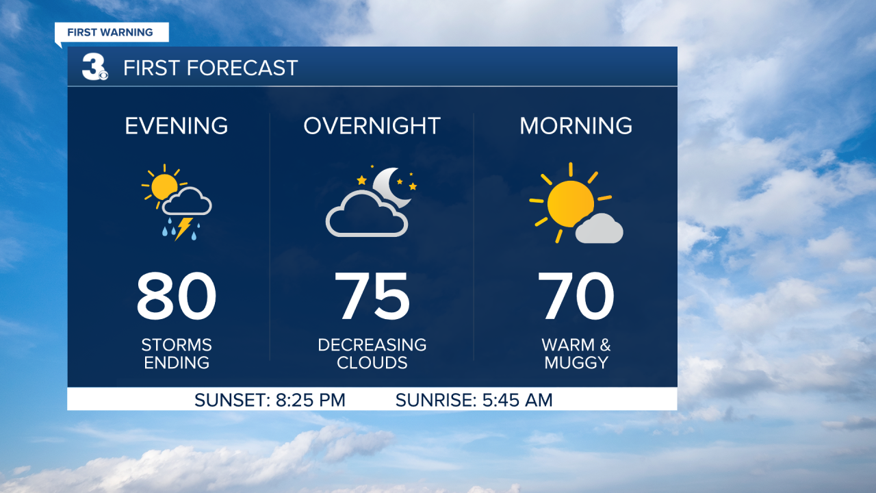
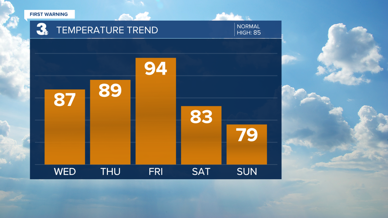
Wednesday will be cooler, but still humid. It'll be cooler near our coastal waters thanks to a east/northeast wind off of the water. Highs will be in the low 80s at the coast and upper 80s inland. We'll start our Wednesday with plenty of sunshine and see a few clouds move in during the afternoon. Most of the day should be dry but an isolated storm will be possible across our far inland locations and near I-95.

Several rounds of storms are on the way as we close out the work week. Both Thursday and Friday will feature scattered showers and storms with highs in the upper 80s Thursday and mid 90s Friday.
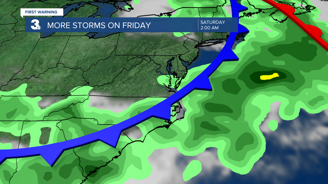
Thank goodness for a cold front that is set to move in Friday evening to Saturday morning. This front will not only clear us of storms for Father's Day weekend, but it'll also usher in cooler and less humid air. Saturday will be breezy with mostly sunny skies and highs in the low 80s. Even cooler for Father's Day and Juneteenth as Sunday will feature highs in the upper 70s under mostly sunny skies.