



Meteorologist Tony Nargi's First Warning Forecast
A severe thunderstorm watch is in effect from now until 10 PM tonight. This evening we have the threat of severe thunderstorms, mainly for the peninsulas and Eastern Shore. Storms will last through 11 PM, with a brief period dry period expected through early tomorrow morning. Lows will drop into the mid 70s.


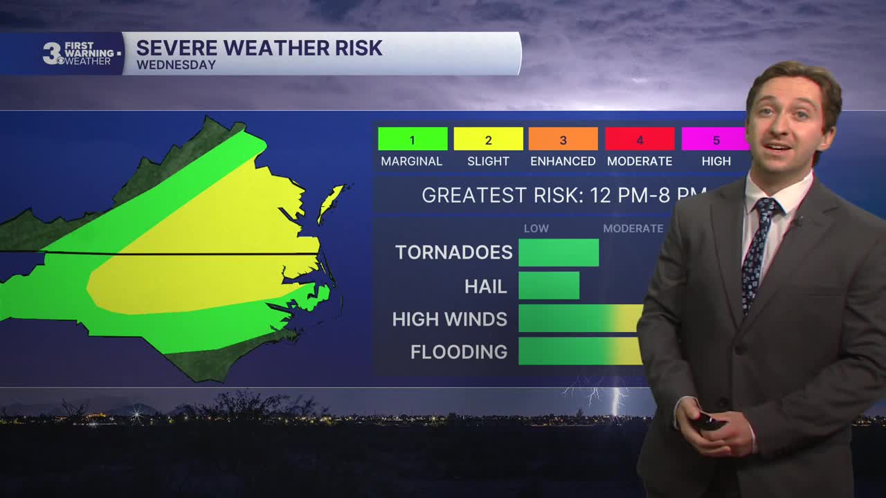
Tomorrow will be cloudy with showers and storms. We'll see on and off rain in the morning transition to stronger storms during the afternoon. Severe storms are possible tomorrow again, with strong wind gusts and flash flooding as the main threats. An isolated tornado cannot be ruled out either. We'll see high temperatures in the mid to upper 80s with winds out of the W at 10-20 mph, gusting up to 35 mph at times. Overnight showers and storms will remain possible, but the severe threat will wane. Rain totals will exceed 1". Lows will drop into the low to mid 70s.


Thursday will be cloudy with on and off rain expected. Rain will be heavy at times, though no severe storms are expected (finally!). We'll see a drop in temps, with highs only reaching the low 80s. Rain totals will be between 1 and 2 inches. Rain should taper off from north to south throughout the evening. Winds will be out of the NE at 10-15 mph. Friday will feature more rain and storms for the Outer Banks, with occasional showers and storms in NE North Carolina. It will stay mainly dry with partly cloudy skies and isolated showers in Virginia. Highs will stay around the low 80s.

This weekend we'll see a mix of clouds and sun, with mainly dry conditions. The best chance for pop-up storms will stay in North Carolina, especially on the Outer Banks.

TROPICS:

Tropical Storm Bertha continues to crawl west and is not expected to strengthen into a Hurricane. The storm is fighting a losing battle against wind shear and Saharan dust currently over the Gulf, and will likely start to weaken by tomorrow morning.
Weather updates on social media:
