


Derrah Getter's First Warning Forecast
This evening will be warm and humid. Highs hover in the mid to upper 70s. A few storms approach our inland spots but most locations remain dry.

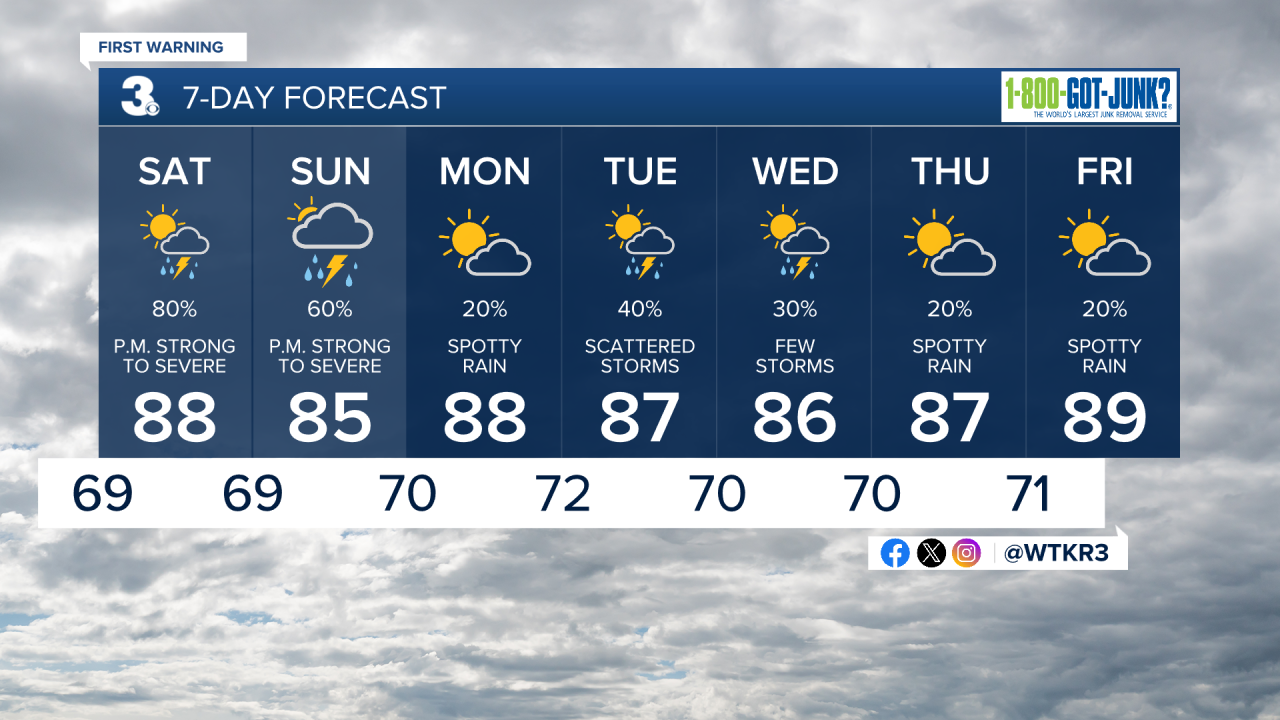
Scattered showers and storms return with an approaching cold front both days this weekend. Our main threats will be damaging wind and hail but an isolated tornado can't be ruled out.

Saturday, highs soar to near 90 degrees. a round of storms will be possible in the afternoon. Sunday features the chance for storms in the morning and again in the afternoon. Highs will be in the mid 80s.
The soggy conditions stretch into next week. We'll see some clearing heading into the following weekend. Highs next week will be in the mid to upper 80s.
Let's connect on social media!
Forecaster Derrah Getter:
For weather updates on Facebook: HERE
For weather updates on X: HERE
Follow me on Instagram: HERE
Check out the Interactive Radar on WTKR.com: Interactive Radar
