

Derrah Getter's First Warning Forecast
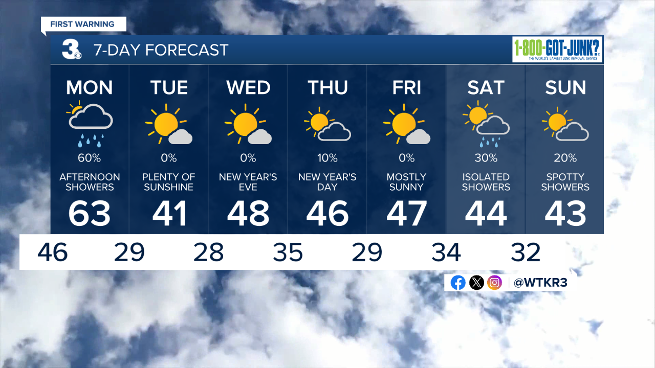
We’ll be stuck underneath the clouds through Monday. Brighter conditions return for most of the week.

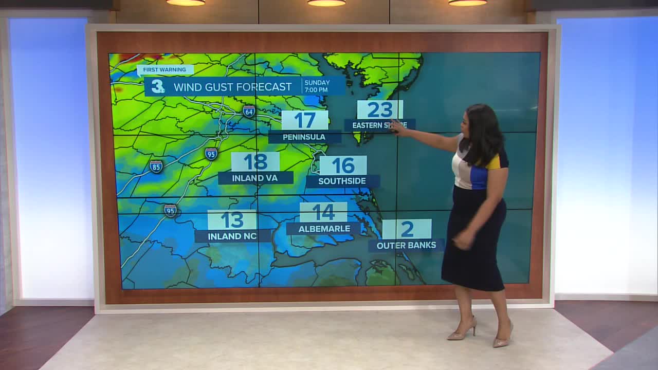
Lows tonight hover in the low to mid 40s underneath mostly cloudy skies. Winds pick up overnight. By Monday morning, winds will gust up to 35 mph. Scattered showers will arrive in the afternoon. Highs reach either side of 60. Skies clear up by the evening.

The rest of next week will be cool with highs in the mid to upper 40s. New Year’s Eve will be cool but there will be plenty of sunshine. A few more clouds will arrive on New Year’s Day with another cold front, but conditions will remain mostly dry.
More rain chances return Saturday and Sunday.
Let's connect on social media!
Forecaster Derrah Getter:
For weather updates on Facebook: HERE
For weather updates on X: HERE
Follow me on Instagram: HERE
Check out the Interactive Radar on WTKR.com: Interactive Radar
