


Meteorologist Tony Nargi's First Warning Forecast
Today will start off with cloudy skies and light rain. We'll see mostly cloudy skies throughout the day, with rain in the morning tapering off by midday. This afternoon we'll see more rain build into North Carolina, with occasional showers possible in Southside and dry but cloudy conditions expected on the Peninsulas/Eastern Shore. High temperatures will only reach the upper 70s. Winds will be out of the NE at 5-15 mph. This evening rain will clear out in NC, with clouds departing from west to east. Lows will drop into the 60s and low 70s along the coast.


Tomorrow will be an excellent day, with mostly sunny skies expected along with low humidity levels as well. High temperatures will reach the low 80s, with light winds out of the NE at 5-10 mph. Overnight some clouds start to fill back in with lows in the 60s.
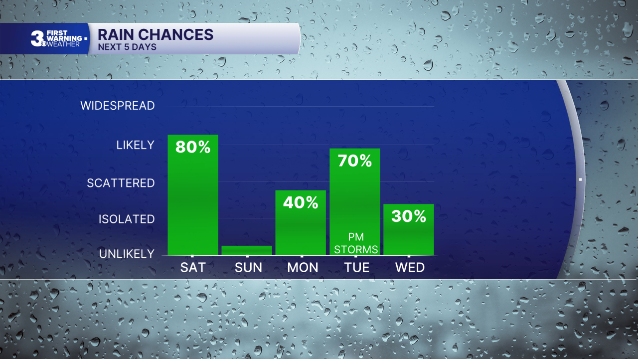
On Monday, some occasional showers will be possible, though the majority of the day will be dry. We'll see high temperatures jump into the mid 80s, with a noticeable jump in humidity expected as well. Tuesday will start off partly cloudy, with warm and very humid conditions expected. Highs will get up to around 90 with strong storms developing during the afternoon/evening.

On Wednesday we'll see some isolated showers and storms along with partly cloudy skies as we begin to dry out. Humidity will drop, and pleasant conditions return Thursday and Friday.

Weather updates on social media:
