


Meteorologist Myles Henderson’s First Warning Forecast
Showers and storms for midweek. A break from the heat and humidity to end the week.
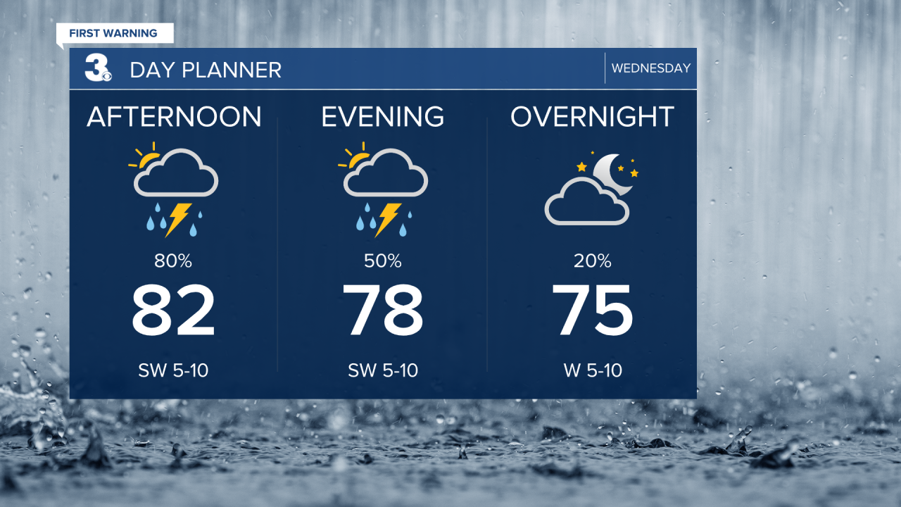
Today will be the soggy day of the week as the cold front slowly slides across the Mid-Atlantic. Biggest rain chances will be this afternoon to early evening. Rain could be heavy at times with some locations seeing over 1” of rainfall. Temperatures will drop to the mid 80s, but it will still be humid.
Highs will linger near 90 on Thursday, near normal for this time of year. Look for a nice mix of mostly sunny to partly cloudy skies.
Very nice for Independence Day! Expect mostly sunny skies with high in the upper 80s and lower humidity.

Highs will remain in the upper 80s to low 90s this weekend. Expect mostly sunny skies on Saturday and partly cloudy skies on Sunday. The humidity will start to increase as we end the weekend and head into next week.
Today: Showers & Storms. Highs in the mid 80s. Winds: SW 5-15
Tonight: Partly Cloudy. Lows in the mid 70s. Winds: W 5-10
Tomorrow: Sun & Clouds. Highs near 90. Winds: W/N/E 5-10
Weather & Health
Pollen: Low (Grasses)
UV Index: 3 (Moderate)
Air Quality: Good (Code Green)
Mosquitoes: Extreme
Tropical Update
An area of low pressure could develop near the southeast U.S. Atlantic or Gulf coasts by this weekend along a weakening frontal boundary. Environmental conditions appear marginally conducive for some slow development, but a tropical or subtropical depression could form in this region over the weekend or early next week.
* Formation chance through 48 hours: Low (0%)
* Formation chance through 7 days: Medium (40%)

Weather updates on social media:
Facebook: MylesHendersonWTKR
Instagram: @MylesHendersonWTKR
