

Meteorologist Maddie Kirker's First Warning Forecast:
Showers to start our St. Patrick's Day, drying out during the afternoon... It wouldn't be St. Patrick's Day without a little bit of rain, would it? We're starting our Thursday with widespread showers, even a few storms and areas of fog.

These pesky showers will continue off and on through lunchtime, before tapering off during the afternoon.
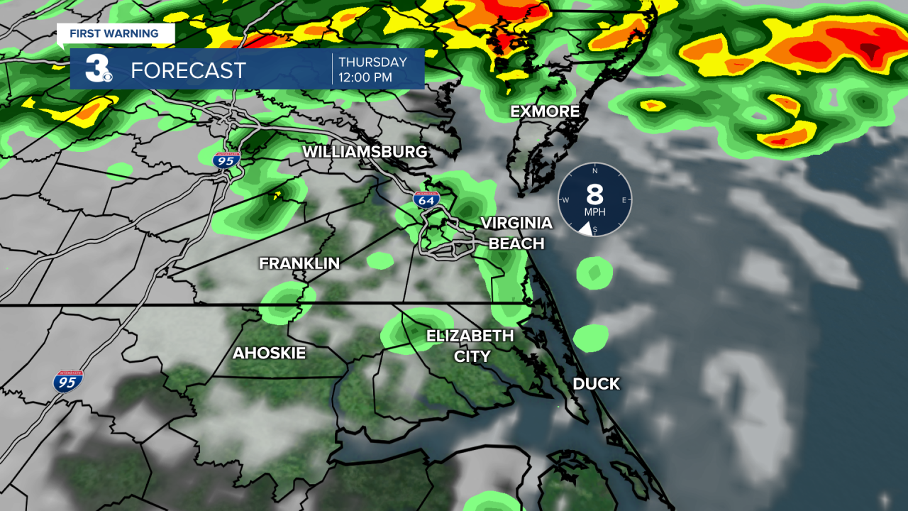
Most of the area will be dry by 5pm except for the Eastern Shore which could have showers until around sunset.

With today's mostly cloudy skies and gloomy start, highs will only warm to the mid and upper 60s.

Friday is shaping up to be a nice day for us. We will warm to the low to mid 70s with a mix of sun and clouds. Most of the day will be dry but showers could sneak in Friday night ahead of our next cold front.
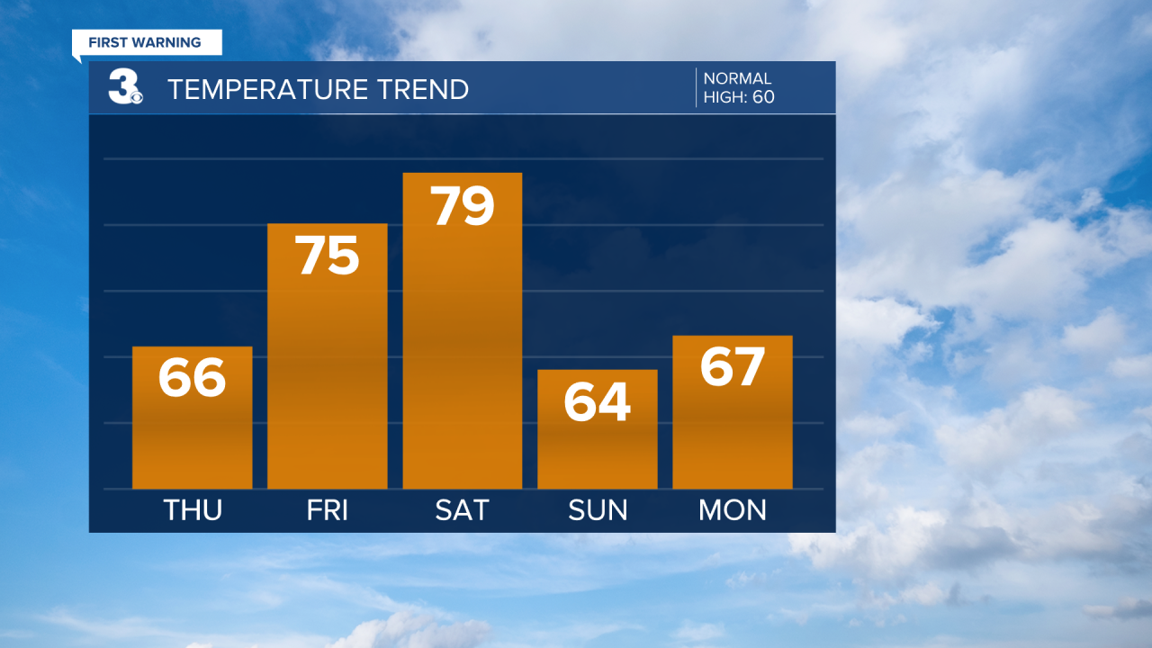
Expect widely scattered showers Saturday (mainly in the morning) as the cold front moves through. Winds will kick up Saturday, SW at 10 to 20 mph. Temperatures will drop behind the cold front from near 80 on Saturday to the mid 60s on Sunday. Sunshine will return for Sunday and winds will back down.
